|
search place name
|
||
Valle de La Cruz (Aragua, Venezuela)Valle de La Cruz is a town in the Aragua region of Venezuela. An overview map of the region around Valle de La Cruz is displayed below.
regional and 3d topo map of Valle de La Cruz, Venezuela ::

Valle de La Cruz airports ::
The nearest airport is CCS - Caracas Simon Bolivar Intl, located 71.5 km north east of Valle de La Cruz.
Other airports nearby include VLN - Valencia Arturo Michelena Intl (76.3 km west), PBL - Puerto Cabello General Bartolome Salom Intl (104.5 km north west), VDP - Valle De La Pascua (162.8 km south east), SFH - San Felipe Sub Teniente Nestor Arias (167.9 km west), Nearby towns ::
Cambural (3.8km east) //
El Algarrobo (5.0km north east) //
Cataurito (5.1km south west) //
Cucharito (6.6km south west) //
El Hoyo (6.8km north west) //
Primer Paso (7.4km south east) //
Hacienda La Matica (7.4km north west) //
Casupo (7.7km north) //
Quebrada Honda (8.3km south) //
Cataure (8.3km north west) //
La Reinosa (8.8km west) //
Cataurón (9.7km north west) //
Oficina Picachito (9.8km north east) //
San Sebastián (10.2km south east) //
[all distances 'as the bird flies' and approximate] 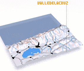 Places with similar names to Valle de La Cruz, Venezuela ::
Disclaimer :: Information on this page comes without warranty of any kind |
||
|
Where is Valle de La Cruz? Elevation and coordinates ::
Latitude (lat): 10°0'30"N Longitude (lon): 67°14'50"W
Elevation (approx.): 532m (map arrows pan, magnifying glasses zoom) |
||
|
Visiting Valle de La Cruz? Hotel/Accommodation ::
Book a hotel in Valle de La Cruz Travel Guide ::
Buy a travel guide for Venezuela rental cars ::
car rental offers GPS waypoint ::
download a GPX waypoint (PoI) of Valle de La Cruz for your GPS receiver
|
||