|
search place name
|
||
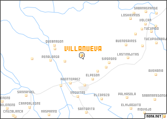
Villanueva (Portuguesa, Venezuela)Villanueva is a town in the Portuguesa region of Venezuela. An overview map of the region around Villanueva is displayed below.
regional and 3d topo map of Villanueva, Venezuela ::
Villanueva airports ::
The nearest airport is GUQ - Guanare, located 28.4 km north east of Villanueva.
Other airports nearby include BNS - Barinas (40.8 km south west), VLV - Valera Dr Antonio Nicolas Briceno (82.5 km north west), AGV - Acarigua Oswaldo Guevara Mujica (109.0 km north east), MRD - Merida Alberto Carnevalli (134.7 km west), Nearby towns ::
Las Peñitas (4.1km west) //
Agua de Angel (4.2km south east) //
El Pegón (4.9km south east) //
Punta (5.4km east) //
Boconoíto (5.8km south) //
Sipororo (5.8km east) //
Puente Paez (6.0km south west) //
Cambi (6.7km west) //
Quebradon (7.1km north west) //
Peña Larga (7.3km west) //
La Marqueseña (7.8km south west) //
Veguitas (8.4km south) //
[all distances 'as the bird flies' and approximate] 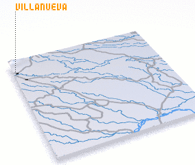 Places with similar names to Villanueva, Venezuela ::
// Val'nëvo (RU)
// Villa Nueva (BO)
// Villa Nueva (BO)
// Villa Nueva (BO)
// Volynovo (RU)
// Vila Nova (PT)
// Vila Nova (PT)
// Vila Nova (PT)
// Vila Nova (PT)
// Vila Nova (PT)
Disclaimer :: Information on this page comes without warranty of any kind |
||
|
Where is Villanueva? Elevation and coordinates ::
Latitude (lat): 8°53'58"N Longitude (lon): 69°58'46"W
Elevation (approx.): 262m (map arrows pan, magnifying glasses zoom) |
||
|
Visiting Villanueva? Hotel/Accommodation ::
Book a hotel in Villanueva Travel Guide ::
Buy a travel guide for Venezuela rental cars ::
car rental offers GPS waypoint ::
download a GPX waypoint (PoI) of Villanueva for your GPS receiver
|
||