|
search place name
|
||
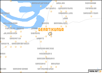
Demati Kunda (Gambia, The)Demati Kunda is a town in Gambia, The. An overview map of the region around Demati Kunda is displayed below.
regional and 3d topo map of Demati Kunda, Gambia, The ::
Demati Kunda airports ::
The nearest airport is KLC - Kaolack, located 119.7 km north west of Demati Kunda.
Other airports nearby include ZIG - Ziguinchor (143.2 km south west), BJL - Banjul Intl (150.2 km west), BXO - Bissau Oswaldo Vieira Intl (169.9 km south), TUD - Tambacounda (179.0 km east), Nearby towns ::
Budayell (0.0km north) //
Dinkirai (0.0km north) //
Sare Nfali (1.8km west) //
Dongoro Ba (1.8km west) //
Willingara Ba (1.9km north) //
Samba Ndama (4.1km south west) //
Dabatu (4.1km south west) //
Bureng (4.1km north west) //
Banniba Jonki (5.2km north east) //
Sibi Nding (5.4km west) //
Saré Samba Cissé (5.8km south) //
Jassong (5.7km west) //
Diaba-Senegal (6.6km north east) //
Missira Doro (7.6km south) //
Joba (7.8km north east) //
Niawoorulung (9.2km north east) //
Hamdalai (9.2km north east) //
[all distances 'as the bird flies' and approximate]  Places with similar names to Demati Kunda, Gambia, The :: Disclaimer :: Information on this page comes without warranty of any kind |
||
|
Where is Demati Kunda? Elevation and coordinates ::
Latitude (lat): 13°23'0"N Longitude (lon): 15°16'0"W
Elevation (approx.): 19m (map arrows pan, magnifying glasses zoom) |
||
|
Visiting Demati Kunda? Hotel/Accommodation ::
Book a hotel in Demati Kunda Travel Guide ::
Buy a travel guide for Gambia, The rental cars ::
car rental offers GPS waypoint ::
download a GPX waypoint (PoI) of Demati Kunda for your GPS receiver
|
||