|
search place name
|
||
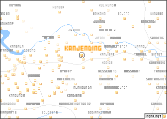
Kanjending (Gambia, The)Kanjending is a town in Gambia, The. An overview map of the region around Kanjending is displayed below.
regional and 3d topo map of Kanjending, Gambia, The ::
Kanjending airports ::
The nearest airport is BJL - Banjul Intl, located 75.2 km west of Kanjending.
Other airports nearby include ZIG - Ziguinchor (82.4 km south west), KLC - Kaolack (101.5 km north), CSK - Cap Skiring (124.3 km south west), BXO - Bissau Oswaldo Vieira Intl (151.9 km south), Nearby towns ::
Mayork (0.0km north) //
Jorem (1.9km south) //
Jorem (1.8km east) //
Kalang (2.6km north east) //
Kayabor (2.6km north east) //
Dasalami (4.1km north east) //
Sangajor (4.9km west) //
Nyafui (4.9km west) //
Nyaffy (5.2km south west) //
Kangwalli (5.2km south east) //
Janding Ba (5.2km south east) //
Janding Jilahar (5.2km south east) //
Jom Kunda (5.2km north west) //
Jifoni (5.2km north east) //
Nyafui (5.4km west) //
Kangwalli (5.4km east) //
Kanjibat (5.4km east) //
Bondali Jola (5.4km west) //
Jorem (5.4km west) //
Bondali Jola (5.4km east) //
Buramba (5.4km east) //
Bajiran (5.6km north) //
Juma Kunda (5.6km west) //
Kangwalli (5.7km east) //
Kalimu (5.7km west) //
Marige (5.7km east) //
Kangwalli (5.7km west) //
Bunobor (5.8km south) //
Jatikoi (5.8km north) //
[all distances 'as the bird flies' and approximate]  Places with similar names to Kanjending, Gambia, The ::
// Kongin-dong (KP)
// Kanjŏn-dong (KP)
Disclaimer :: Information on this page comes without warranty of any kind |
||
|
Where is Kanjending? Elevation and coordinates ::
Latitude (lat): 13°14'0"N Longitude (lon): 15°58'0"W
Elevation (approx.): 27m (map arrows pan, magnifying glasses zoom) |
||
|
Visiting Kanjending? Hotel/Accommodation ::
Book a hotel in Kanjending Travel Guide ::
Buy a travel guide for Gambia, The rental cars ::
car rental offers GPS waypoint ::
download a GPX waypoint (PoI) of Kanjending for your GPS receiver
|
||