|
search place name
|
||
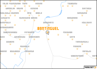
Bantinguel (Dinguiraye, Guinea)Bantinguel is a town in the Dinguiraye region of Guinea. An overview map of the region around Bantinguel is displayed below.
regional and 3d topo map of Bantinguel, Guinea ::
Bantinguel airports ::
The nearest airport is KGG - Kedougou, located 192.0 km west of Bantinguel.
Other airports nearby include LEK - Labe (200.5 km west), FAA - Faranah (214.8 km south), Nearby towns ::
Diogoya (1.9km south) //
Galama (2.6km north west) //
Dandémayo (3.7km north) //
Diata Torobé (3.6km east) //
Sabéré Bani (5.7km west) //
Fatagania (7.3km west) //
Fokoumba (7.3km east) //
Baniré (7.8km north west) //
Babila (8.3km north west) //
Afia (10.4km north west) //
Fandanda (10.4km south west) //
[all distances 'as the bird flies' and approximate] 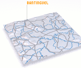 Places with similar names to Bantinguel, Guinea ::
// Bantinguil (PH)
// Ban Don Klao (TH)
// Ban Don Kloi (TH)
// Ban Don Kloi (TH)
// Ban Don Kloi (TH)
// Ban Don Kloi (TH)
// Ban Don Kloi (TH)
// Ban Don Kloi (TH)
// Ban Ton Klua (TH)
// Bandangala (GA)
Disclaimer :: Information on this page comes without warranty of any kind |
||
|
Where is Bantinguel? Elevation and coordinates ::
Latitude (lat): 11°58'0"N Longitude (lon): 10°34'0"W
Elevation (approx.): 331m (map arrows pan, magnifying glasses zoom) |
||
|
Visiting Bantinguel? Hotel/Accommodation ::
Book a hotel in Bantinguel Travel Guide ::
Buy a travel guide for Guinea rental cars ::
car rental offers GPS waypoint ::
download a GPX waypoint (PoI) of Bantinguel for your GPS receiver
|
||