|
search place name
|
||
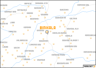
Binikala (Macenta, Guinea)Binikala is a town in the Macenta region of Guinea. An overview map of the region around Binikala is displayed below.
regional and 3d topo map of Binikala, Guinea ::
Binikala airports ::
The nearest airport is FAA - Faranah, located 194.1 km north west of Binikala.
Other airports nearby include MJC - Man (272.0 km south east), Nearby towns ::
Boézia (1.4km north east) //
Salamaï (2.7km south west) //
Sinséou (2.7km west) //
Sogonimaï (4.1km south) //
Doulama (4.5km south east) //
Kavélegourou (4.6km east) //
Sansamadou (5.4km east) //
Segbemaï (5.5km north east) //
Fonéssou (5.7km south) //
Leïfèro (6.5km east) //
Souamaï (6.7km north) //
Béoramaï (6.9km north west) //
Zimbessou (7.1km north east) //
Malléma (7.1km south) //
Laménéssou (7.1km south west) //
Niaourassou (7.1km north east) //
Ouokouama (7.3km north east) //
Koromai (7.9km west) //
Darazou (8.1km north west) //
Bassidou (8.1km south east) //
Konéla (8.5km east) //
Fassala (8.6km north) //
Dog (9.1km south west) //
Maomaï (9.8km north west) //
Diataïdou (10.4km south west) //
Ouazémaï (10.6km north east) //
Bofouzou (10.9km north west) //
[all distances 'as the bird flies' and approximate] 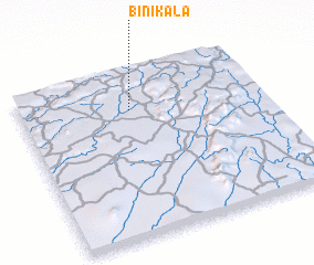 Places with similar names to Binikala, Guinea ::
Disclaimer :: Information on this page comes without warranty of any kind |
||
|
Where is Binikala? Elevation and coordinates ::
Latitude (lat): 8°46'24"N Longitude (lon): 9°32'30"W
Elevation (approx.): 577m (map arrows pan, magnifying glasses zoom) |
||
|
Visiting Binikala? Hotel/Accommodation ::
Book a hotel in Binikala Travel Guide ::
Buy a travel guide for Guinea rental cars ::
car rental offers GPS waypoint ::
download a GPX waypoint (PoI) of Binikala for your GPS receiver
|
||