|
search place name
|
||
Binngaldi (Mali, Guinea)Binngaldi is a town in the Mali region of Guinea. An overview map of the region around Binngaldi is displayed below.
regional and 3d topo map of Binngaldi, Guinea ::

Binngaldi airports ::
The nearest airport is KGG - Kedougou, located 39.0 km north east of Binngaldi.
Other airports nearby include LEK - Labe (102.6 km south), TUD - Tambacounda (215.7 km north west), FIG - Fira Fria (247.8 km south west), Nearby towns ::
Nagoudou (1.8km west) //
Nadel Sabé (1.9km north) //
Danda (1.9km north) //
Kouyé (2.6km north east) //
Boudoulémoni (4.1km north west) //
Nionkoba (4.1km north west) //
Kérouané (4.1km south east) //
Téguérang (5.2km south east) //
Lougana (5.7km east) //
Dira (7.6km south) //
Somma (9.1km south east) //
Bennsori (9.2km south east) //
[all distances 'as the bird flies' and approximate] 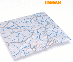 Places with similar names to Binngaldi, Guinea ::
// Benglat (PH)
// Ban Klet (TH)
// Ban Kui Loe To (TH)
// Ban Na Klua Tai (TH)
// Bongoletu (ZA)
// Bānglāt (BD)
// Boungoulti (TD)
// Banco Alto (VE)
// Banco Alto (VE)
// Banco Alto (VE)
Disclaimer :: Information on this page comes without warranty of any kind |
||
|
Where is Binngaldi? Elevation and coordinates ::
Latitude (lat): 12°15'0"N Longitude (lon): 12°22'0"W
Elevation (approx.): 575m (map arrows pan, magnifying glasses zoom) |
||
|
Visiting Binngaldi? Hotel/Accommodation ::
Book a hotel in Binngaldi Travel Guide ::
Buy a travel guide for Guinea rental cars ::
car rental offers GPS waypoint ::
download a GPX waypoint (PoI) of Binngaldi for your GPS receiver
|
||