|
search place name
|
||
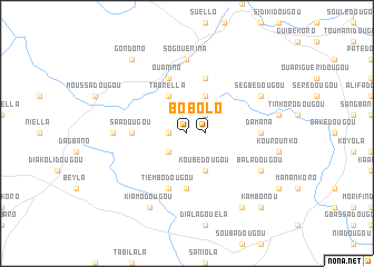
Bolo (Beyla, Guinea)Bolo is a town in the Beyla region of Guinea. An overview map of the region around Bolo is displayed below.
regional and 3d topo map of Bolo, Guinea ::
Bolo airports ::
The nearest airport is MJC - Man, located 192.3 km south east of Bolo.
Nearby towns ::
Bolo (1.8km east) //
Fanou (1.8km west) //
Saniola (2.6km north east) //
Bandiamodougou (2.6km south west) //
Biramadougou (2.6km north east) //
Diakoro (2.6km north east) //
Koubédougou (4.1km south east) //
Kounéna (4.1km north east) //
Taorella (4.1km north west) //
Saadougou (5.5km west) //
Sillakollo (5.6km south) //
Kéborédougou (5.9km north) //
Tiembodougou (5.9km south) //
Ouanino (5.9km north) //
Damana (7.3km east) //
Bouboukoro (7.3km west) //
Sogouénina (7.4km north) //
Baladougou (8.2km south east) //
Kiamodougou (8.3km south west) //
Segbédougou (8.2km north east) //
Biendougou (9.2km south east) //
Gondono (9.2km north west) //
Kambonou (10.4km south east) //
[all distances 'as the bird flies' and approximate] 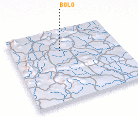 Places with similar names to Bolo, Guinea ::
Disclaimer :: Information on this page comes without warranty of any kind |
||
|
Where is Bolo? Elevation and coordinates ::
Latitude (lat): 8°44'0"N Longitude (lon): 8°32'0"W
Elevation (approx.): 847m (map arrows pan, magnifying glasses zoom) |
||
|
Visiting Bolo? Hotel/Accommodation ::
Book a hotel in Bolo Travel Guide ::
Buy a travel guide for Guinea rental cars ::
car rental offers GPS waypoint ::
download a GPX waypoint (PoI) of Bolo for your GPS receiver
|
||