|
search place name
|
||
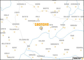
Gbonoma (Guinea)Gbonoma is a town in Guinea. An overview map of the region around Gbonoma is displayed below.
regional and 3d topo map of Gbonoma, Guinea ::
Gbonoma airports ::
The nearest airport is MJC - Man, located 163.7 km south east of Gbonoma.
Other airports nearby include ROB - Monrovia Roberts Intl (253.7 km south west), MLW - Monrovia Spriggs Payne (279.7 km south west), Nearby towns ::
Diogouinta (3.1km east) //
Ninata (4.0km east) //
Niaragbaleye (4.6km north west) //
Palé (5.1km north) //
Dapore (5.9km east) //
Koloda (5.9km south) //
Koaliépoulou (7.1km south) //
Bénéouli (8.6km north) //
Ouyéyé (8.7km north west) //
Bienta (8.8km north) //
Diomanta (8.8km north east) //
Gbagouné (9.4km south east) //
Kélémadiou (9.5km south west) //
Poé (10.1km south west) //
Gota (10.3km north east) //
Sélo (11.4km north east) //
[all distances 'as the bird flies' and approximate]  Places with similar names to Gbonoma, Guinea ::
Disclaimer :: Information on this page comes without warranty of any kind |
||
|
Where is Gbonoma? Elevation and coordinates ::
Latitude (lat): 7°59'23"N Longitude (lon): 8°53'5"W
Elevation (approx.): 445m (map arrows pan, magnifying glasses zoom) |
||
|
Visiting Gbonoma? Hotel/Accommodation ::
Book a hotel in Gbonoma Travel Guide ::
Buy a travel guide for Guinea rental cars ::
car rental offers GPS waypoint ::
download a GPX waypoint (PoI) of Gbonoma for your GPS receiver
|
||