|
search place name
|
||
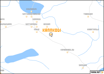
Kannkodi (Gaoual, Guinea)Kannkodi is a town in the Gaoual region of Guinea. An overview map of the region around Kannkodi is displayed below.
regional and 3d topo map of Kannkodi, Guinea ::
Kannkodi airports ::
The nearest airport is KGG - Kedougou, located 160.6 km east of Kannkodi.
Other airports nearby include LEK - Labe (172.8 km south east), TUD - Tambacounda (175.6 km north), FIG - Fira Fria (199.2 km south), Nearby towns ::
Bissan (4.1km north west) //
Kadié (5.7km west) //
Kitiara (6.6km north west) //
Korassi (7.8km north west) //
Kambambolou (7.8km south east) //
Sintiân Modi (8.1km north west) //
Sintiou Demba Diao (10.4km north west) //
[all distances 'as the bird flies' and approximate] 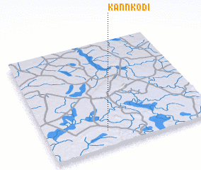 Places with similar names to Kannkodi, Guinea ::
Disclaimer :: Information on this page comes without warranty of any kind |
||
|
Where is Kannkodi? Elevation and coordinates ::
Latitude (lat): 12°9'0"N Longitude (lon): 13°38'0"W
Elevation (approx.): 104m (map arrows pan, magnifying glasses zoom) |
||
|
Visiting Kannkodi? Hotel/Accommodation ::
Book a hotel in Kannkodi Travel Guide ::
Buy a travel guide for Guinea rental cars ::
car rental offers GPS waypoint ::
download a GPX waypoint (PoI) of Kannkodi for your GPS receiver
|
||