|
search place name
|
||
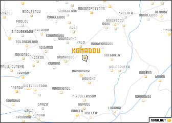
Komadou (Macenta, Guinea)Komadou is a town in the Macenta region of Guinea. An overview map of the region around Komadou is displayed below.
regional and 3d topo map of Komadou, Guinea ::
Komadou airports ::
The nearest airport is FAA - Faranah, located 220.1 km north west of Komadou.
Other airports nearby include MJC - Man (252.8 km south east), Nearby towns ::
Madionamaï (3.1km south) //
Kalo (3.5km north) //
Moreguebédou (3.5km north west) //
Diomandou (4.4km west) //
Bandèoradou (4.6km north east) //
Madiomaï (4.7km south) //
Ouéguota (5.6km east) //
Sourounka (5.7km north west) //
Bokoni (5.9km east) //
Daro (7.0km north west) //
Kabaro (7.0km west) //
Kolobouéta (7.5km east) //
Koïbirédou (8.2km north west) //
Niavollassou (8.4km south) //
Baou (8.5km north east) //
Mawukondu (8.6km south west) //
Moïdiaro (9.0km west) //
Doussoudiaradou (9.2km north west) //
Bouroume (9.5km north east) //
Diegbedou (10.3km north east) //
Kobélédou (10.9km north west) //
Fokodoumandou (11.2km north east) //
[all distances 'as the bird flies' and approximate] 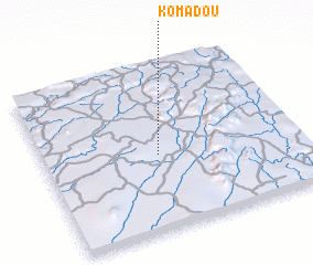 Places with similar names to Komadou, Guinea ::
Disclaimer :: Information on this page comes without warranty of any kind |
||
|
Where is Komadou? Elevation and coordinates ::
Latitude (lat): 8°27'32"N Longitude (lon): 9°32'49"W
Elevation (approx.): 568m (map arrows pan, magnifying glasses zoom) |
||
|
Visiting Komadou? Hotel/Accommodation ::
Book a hotel in Komadou Travel Guide ::
Buy a travel guide for Guinea rental cars ::
car rental offers GPS waypoint ::
download a GPX waypoint (PoI) of Komadou for your GPS receiver
|
||