|
search place name
|
||
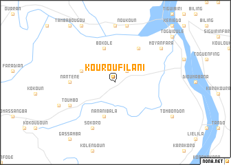
Kourou Filani (Guinea)Kourou Filani is a town in Guinea. An overview map of the region around Kourou Filani is displayed below.
regional and 3d topo map of Kourou Filani, Guinea ::
Kourou Filani airports ::
The nearest airport is BKO - Bamako Senou, located 199.2 km north east of Kourou Filani.
Other airports nearby include FAA - Faranah (214.9 km south west), Nearby towns ::
Seymana (2.6km north east) //
Kourouba (5.8km west) //
Bokolé (5.8km north) //
Nananibala (5.8km south) //
Dougoulengui (6.6km north east) //
Nanténé (7.3km west) //
Sokoro (8.3km south west) //
Toumbo (8.2km south west) //
Moyanfara (9.2km north east) //
[all distances 'as the bird flies' and approximate] 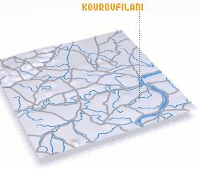 Places with similar names to Kourou Filani, Guinea ::
// Gravelon (CH)
// Garfeln (DE)
// Gravellino (IT)
// Corvillón (ES)
// Crivillén (ES)
// Gar-e Fahlīān (IR)
// Gravellona (IT)
// Curraghaleen (IE)
// Curraghlane (IE)
// Keravilin (FR)
Disclaimer :: Information on this page comes without warranty of any kind |
||
|
Where is Kourou Filani? Elevation and coordinates ::
Latitude (lat): 11°16'0"N Longitude (lon): 9°15'0"W
Elevation (approx.): 395m (map arrows pan, magnifying glasses zoom) |
||
|
Visiting Kourou Filani? Hotel/Accommodation ::
Book a hotel in Kourou Filani Travel Guide ::
Buy a travel guide for Guinea rental cars ::
car rental offers GPS waypoint ::
download a GPX waypoint (PoI) of Kourou Filani for your GPS receiver
|
||