|
search place name
|
||
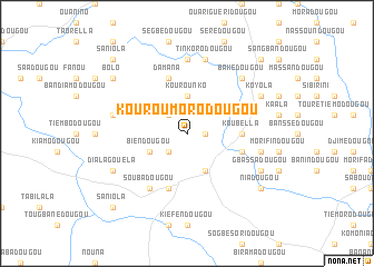
Kouroumorodougou (Beyla, Guinea)Kouroumorodougou is a town in the Beyla region of Guinea. An overview map of the region around Kouroumorodougou is displayed below.
regional and 3d topo map of Kouroumorodougou, Guinea ::
Kouroumorodougou airports ::
The nearest airport is MJC - Man, located 182.8 km south east of Kouroumorodougou.
Other airports nearby include DJO - Daloa (302.1 km south east), Nearby towns ::
Manankoro (1.8km east) //
Kambonou (2.6km south west) //
Baladougou (2.6km north west) //
Kourounko (3.7km north) //
Biendougou (4.1km south west) //
Féréborédougou (4.1km south east) //
Koubella (5.5km east) //
Moribadougou (5.8km east) //
Gouasséridougou (5.8km east) //
Kamorodougou (5.9km south) //
Damana (5.9km north) //
Soubadougou (6.7km south west) //
Gouakédougou (7.4km north) //
Niokorogbédougou (7.4km north) //
Késséridougou (7.6km east) //
Tinkorodougou (7.6km north) //
Koubédougou (7.6km west) //
Bakédougou (7.8km north east) //
Gbassadougou (8.2km south east) //
Dialagouéla (8.2km south west) //
Koyola (8.2km north east) //
Niadougou (9.2km south east) //
Bolo (9.2km north west) //
Saniola (10.4km south west) //
Nissiboro (10.4km north east) //
Saniola (10.4km north west) //
Biramadougou (10.4km north west) //
Diakoro (10.4km north west) //
[all distances 'as the bird flies' and approximate]  Places with similar names to Kouroumorodougou, Guinea ::
// Krémertag (HU)
// Koromoridougou (GN)
Disclaimer :: Information on this page comes without warranty of any kind |
||
|
Where is Kouroumorodougou? Elevation and coordinates ::
Latitude (lat): 8°41'0"N Longitude (lon): 8°27'0"W
Elevation (approx.): 692m (map arrows pan, magnifying glasses zoom) |
||
|
Visiting Kouroumorodougou? Hotel/Accommodation ::
Book a hotel in Kouroumorodougou Travel Guide ::
Buy a travel guide for Guinea rental cars ::
car rental offers GPS waypoint ::
download a GPX waypoint (PoI) of Kouroumorodougou for your GPS receiver
|
||