|
search place name
|
||
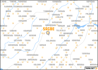
Sagbé (Guékédou, Guinea)Sagbé is a town in the Guékédou region of Guinea. An overview map of the region around Sagbé is displayed below.
regional and 3d topo map of Sagbé, Guinea ::
Sagbé airports ::
The nearest airport is FAA - Faranah, located 177.2 km north of Sagbé.
Nearby towns ::
Mongo (1.3km north) //
Tongolo (1.5km south east) //
Maa (2.0km west) //
Dogbodou (2.7km west) //
Ouamandou (2.9km north) //
Koloadou (3.2km south) //
Télécolo (4.6km east) //
Dinguédou (5.0km north east) //
Baoua (5.0km east) //
Kessedou (5.2km north west) //
Sandia (5.3km south west) //
Nongoa (5.4km north east) //
Sangadou (5.5km north) //
Foa (5.6km south east) //
Yaradou (5.8km south east) //
Kako (6.4km north) //
Kenema (6.4km west) //
Nyandeama (6.7km south east) //
Kolifa (7.2km north east) //
Bombodou (7.3km east) //
Yaradou (7.4km north) //
Sanga (7.5km south east) //
Owé (7.9km east) //
Timbandou (8.2km north) //
Kouango (8.2km west) //
Kpayamalu (8.6km south) //
Tédou (8.6km west) //
Gomandou (8.9km south) //
Sakpe (9.0km south) //
[all distances 'as the bird flies' and approximate] 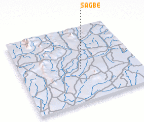 Places with similar names to Sagbé, Guinea ::
Disclaimer :: Information on this page comes without warranty of any kind |
||
|
Where is Sagbé? Elevation and coordinates ::
Latitude (lat): 8°27'35"N Longitude (lon): 10°28'34"W
Elevation (approx.): 367m (map arrows pan, magnifying glasses zoom) |
||
|
Visiting Sagbé? Hotel/Accommodation ::
Book a hotel in Sagbé Travel Guide ::
Buy a travel guide for Guinea rental cars ::
car rental offers GPS waypoint ::
download a GPX waypoint (PoI) of Sagbé for your GPS receiver
|
||