|
search place name
|
||
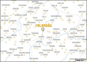
Yalandou (Guékédou, Guinea)Yalandou is a town in the Guékédou region of Guinea. An overview map of the region around Yalandou is displayed below.
regional and 3d topo map of Yalandou, Guinea ::
Yalandou airports ::
The nearest airport is FAA - Faranah, located 152.8 km north west of Yalandou.
Nearby towns ::
Tinkia (0.3km west) //
Fèro (1.7km south) //
Yembadou (1.8km east) //
Kola (2.6km east) //
Kointo (3.6km south) //
Bendou (3.9km north east) //
Youadou (4.1km south west) //
Kiekama (4.1km north west) //
Koïndou (4.1km north west) //
Yandandou (4.1km north west) //
Guélo (4.5km south east) //
Konian (4.5km east) //
Guéckédou Harry (4.7km west) //
Kama (5.2km north east) //
Tolli (5.3km north) //
Saadou (5.5km east) //
Fassaba (5.8km east) //
Dindian (5.9km south) //
Sindebaro (5.9km north west) //
Bandoni (6.0km west) //
Kiéto (6.1km north west) //
Guéla (6.5km south east) //
Pondodou (6.7km south west) //
Kiéssané (6.8km west) //
Kamadou (7.3km south east) //
Balo (7.4km north) //
Kongola (7.4km north) //
Méla (7.4km north) //
Soro (7.3km west) //
[all distances 'as the bird flies' and approximate] 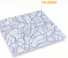 Places with similar names to Yalandou, Guinea ::
Disclaimer :: Information on this page comes without warranty of any kind |
||
|
Where is Yalandou? Elevation and coordinates ::
Latitude (lat): 8°50'0"N Longitude (lon): 10°5'0"W
Elevation (approx.): 455m (map arrows pan, magnifying glasses zoom) |
||
|
Visiting Yalandou? Hotel/Accommodation ::
Book a hotel in Yalandou Travel Guide ::
Buy a travel guide for Guinea rental cars ::
car rental offers GPS waypoint ::
download a GPX waypoint (PoI) of Yalandou for your GPS receiver
|
||