|
search place name
|
||
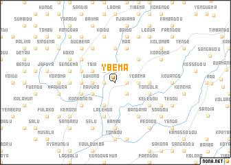
Ybéma (Guékédou, Guinea)Ybéma is a town in the Guékédou region of Guinea. An overview map of the region around Ybéma is displayed below.
regional and 3d topo map of Ybéma, Guinea ::
Ybéma airports ::
The nearest airport is FAA - Faranah, located 174.2 km north of Ybéma.
Nearby towns ::
Péoaou (1.8km east) //
Yogbodu (1.9km north) //
Bwedu (1.9km north) //
Kundu (1.9km north) //
Bwedu (1.8km west) //
Bassédou (2.6km south east) //
Kundowahun (2.6km north west) //
Yébéma (3.7km east) //
Dukono (3.7km west) //
Taia (4.1km north west) //
Navuro (4.1km south west) //
Folodu (4.1km south west) //
Fangamandou (5.2km north east) //
Konkoworo (5.5km west) //
Dugbudu (5.6km north) //
Taguafou (5.5km east) //
Bandama (5.8km west) //
Maa (5.9km north) //
Lalehun (5.9km south) //
Moimardu (5.8km west) //
Tongola (5.8km east) //
Sukudu (6.6km north west) //
Koniandou (6.7km south east) //
Bandama (6.7km south east) //
Konkonani (6.6km south west) //
Bambara (6.7km north west) //
Kélédou (6.6km south east) //
Bamba (7.4km south) //
Bumpe (7.3km west) //
[all distances 'as the bird flies' and approximate] 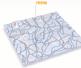 Places with similar names to Ybéma, Guinea ::
Disclaimer :: Information on this page comes without warranty of any kind |
||
|
Where is Ybéma? Elevation and coordinates ::
Latitude (lat): 8°28'0"N Longitude (lon): 10°38'0"W
Elevation (approx.): 278m (map arrows pan, magnifying glasses zoom) |
||
|
Visiting Ybéma? Hotel/Accommodation ::
Book a hotel in Ybéma Travel Guide ::
Buy a travel guide for Guinea rental cars ::
car rental offers GPS waypoint ::
download a GPX waypoint (PoI) of Ybéma for your GPS receiver
|
||