|
search place name
|
||
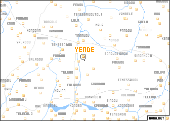
Yendé (Guékédou, Guinea)Yendé is a town in the Guékédou region of Guinea. An overview map of the region around Yendé is displayed below.
regional and 3d topo map of Yendé, Guinea ::
Yendé airports ::
The nearest airport is FAA - Faranah, located 168.1 km north of Yendé.
Nearby towns ::
Toli Ouladin (1.4km west) //
Kolignindo (2.3km north east) //
Sofédou (2.6km south west) //
Bambadou (2.6km north west) //
Kondoma (2.6km south east) //
Koutambadou (3.2km south) //
Baladou (4.1km south west) //
Kolibanda (4.2km north) //
Yrandou (4.4km north) //
Télébo (5.2km south west) //
Témessadou (5.4km north west) //
Fandou (5.5km west) //
Fandou (5.8km west) //
Bédou (6.6km north east) //
Falanko (6.8km south) //
Gbandou (7.0km south east) //
Sandja Tongui (7.0km east) //
Mongo (7.3km north east) //
Dénekendou (7.3km west) //
Mala (7.6km north east) //
Dangdou (7.6km south west) //
Yomadou (7.6km south) //
Foédou (7.6km east) //
Kendou (7.8km south west) //
Pasquetdou (7.8km north east) //
Lèla (8.0km north) //
Kamadou (8.2km north west) //
Beressa (8.2km west) //
Nongoa (8.8km south) //
[all distances 'as the bird flies' and approximate] 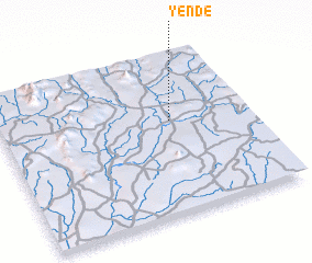 Places with similar names to Yendé, Guinea ::
Disclaimer :: Information on this page comes without warranty of any kind |
||
|
Where is Yendé? Elevation and coordinates ::
Latitude (lat): 8°35'0"N Longitude (lon): 10°19'0"W
Elevation (approx.): 415m (map arrows pan, magnifying glasses zoom) |
||
|
Visiting Yendé? Hotel/Accommodation ::
Book a hotel in Yendé Travel Guide ::
Buy a travel guide for Guinea rental cars ::
car rental offers GPS waypoint ::
download a GPX waypoint (PoI) of Yendé for your GPS receiver
|
||