|
search place name
|
||
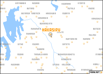
Hakasiru (Ruhengeri, Rwanda)Hakasiru is a town in the Ruhengeri region of Rwanda. An overview map of the region around Hakasiru is displayed below.
regional and 3d topo map of Hakasiru, Rwanda ::
Hakasiru airports ::
The nearest airport is KGL - Kigali Intl, located 59.9 km south east of Hakasiru.
Other airports nearby include GYI - Gisenyi (74.5 km west), GOM - Goma (76.5 km west), BKY - Bukavu/kavumu Bukavu Kavumu (151.9 km south west), KME - Kamembe (154.6 km south west), Nearby towns ::
Butandi (0.0km north) //
Kivuye (3.5km east) //
Bugindi (3.7km east) //
Bukaragata (4.1km north west) //
Bisaga (5.6km west) //
Ruhurura (5.9km west) //
Kashasha (6.5km north west) //
Rubona (6.7km south west) //
Rugari (6.7km south west) //
Gatete (6.7km south east) //
Buberuka (7.2km west) //
Hakekuba (7.4km north) //
Ruhanga (7.4km west) //
Rubona (7.6km south) //
Muryorera (7.6km east) //
Tandalukara (8.3km south west) //
Kabyaza (9.3km north west) //
Rubaya (9.3km north east) //
Nemba (9.3km south west) //
Bushingamohetu (9.3km south east) //
[all distances 'as the bird flies' and approximate] 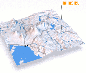 Places with similar names to Hakasiru, Rwanda ::
// Hagosa-ri (KR)
// Haksai-ri (KR)
// Haksu-ri (KP)
// Hŭksu-ri (KP)
// Hŭksu-ri (KP)
// Hakso-ri (KP)
// Haikosaari (FI)
// Haukisaari (FI)
// Högsar (FI)
// Högsåra (FI)
Disclaimer :: Information on this page comes without warranty of any kind |
||
|
Where is Hakasiru? Elevation and coordinates ::
Latitude (lat): 1°29'0"S Longitude (lon): 29°54'0"E
Elevation (approx.): 2064m (map arrows pan, magnifying glasses zoom) |
||
|
Visiting Hakasiru? Hotel/Accommodation ::
Book a hotel in Hakasiru Travel Guide ::
Buy a travel guide for Rwanda rental cars ::
car rental offers GPS waypoint ::
download a GPX waypoint (PoI) of Hakasiru for your GPS receiver
|
||