|
search place name
|
||
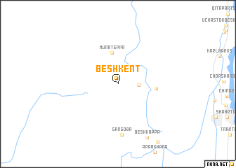
Beshkent (Khatlon, Tajikistan)Beshkent is a town in the Khatlon region of Tajikistan. An overview map of the region around Beshkent is displayed below.
regional and 3d topo map of Beshkent, Tajikistan ::
Beshkent airports ::
The nearest airport is MZR - Mazar-i-sharif Mazar I Sharif, located 95.5 km south west of Beshkent.
Other airports nearby include UND - Kunduz Konduz (109.3 km south east), DYU - Dushanbe (156.1 km north east), Nearby towns ::
Staryy Tulkhar (2.7km east) //
Murateppa (5.0km north) //
Chali-Char-Chashma (4.9km east) //
Sangoba (8.1km south) //
Beshkappa (9.3km south east) //
[all distances 'as the bird flies' and approximate] 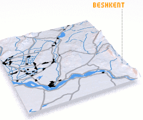 Places with similar names to Beshkent, Tajikistan ::
// Bāsh Kand (IR)
// Bāsh Kand (IR)
// Bāshkand (IR)
// Batiakaunda (CD)
// Bichkunda (IN)
// Bash-Kaindy (KG)
// Beshkent (KG)
// Beshkent (UZ)
// Bīch Kund (PK)
// Bishkent (TJ)
Disclaimer :: Information on this page comes without warranty of any kind |
||
|
Where is Beshkent? Elevation and coordinates ::
Latitude (lat): 37°18'24"N Longitude (lon): 67°58'44"E
Elevation (approx.): 392m (map arrows pan, magnifying glasses zoom) |
||
|
Visiting Beshkent? Hotel/Accommodation ::
Book a hotel in Beshkent Travel Guide ::
Buy a travel guide for Tajikistan rental cars ::
car rental offers GPS waypoint ::
download a GPX waypoint (PoI) of Beshkent for your GPS receiver
|
||