|
search place name
|
||
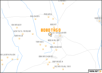
Bobotago ((( Kulyabskaya Oblast' )), Tajikistan)Bobotago is a town in the (( Kulyabskaya Oblast' )) region of Tajikistan. An overview map of the region around Bobotago is displayed below.
regional and 3d topo map of Bobotago, Tajikistan ::
Bobotago airports ::
The nearest airport is DYU - Dushanbe, located 152.0 km south of Bobotago.
Other airports nearby include TAS - Tashkent Yuzhny (152.2 km north), SKD - Samarkand (172.3 km west), Nearby towns ::
Bogikalon (2.5km south) //
Istaravshan (2.5km east) //
Bogat (3.6km north) //
Saksiyon (3.6km south west) //
Tapkok (4.2km south west) //
Obdzhuvoz (5.0km south) //
Ak-Guaz-Kaaz (5.1km south west) //
Khuzya (6.6km north) //
Almaly (5.3km west) //
Rugund (7.3km north) //
Obkarchagay (8.3km south) //
Nidzhoni (7.8km north west) //
[all distances 'as the bird flies' and approximate] 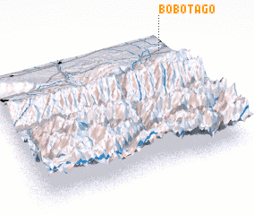 Places with similar names to Bobotago, Tajikistan ::
// Bēbātki (IQ)
// Babadag (RO)
// Babadağ (TR)
// Beibutuk (TP)
// Bibi Doga (PK)
// Babédougou (GN)
// Bouébouédougou (GN)
// Baba Doka (NG)
// Babotki (RU)
// Bu Bitt (2) (VN)
Disclaimer :: Information on this page comes without warranty of any kind |
||
|
Where is Bobotago? Elevation and coordinates ::
Latitude (lat): 39°54'26"N Longitude (lon): 68°58'39"E
Elevation (approx.): 1006m (map arrows pan, magnifying glasses zoom) |
||
|
Visiting Bobotago? Hotel/Accommodation ::
Book a hotel in Bobotago Travel Guide ::
Buy a travel guide for Tajikistan rental cars ::
car rental offers GPS waypoint ::
download a GPX waypoint (PoI) of Bobotago for your GPS receiver
|
||