|
search place name
|
||
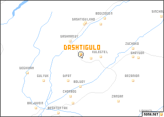
Dashtigulo ((( Kulyabskaya Oblast' )), Tajikistan)Dashtigulo is a town in the (( Kulyabskaya Oblast' )) region of Tajikistan. An overview map of the region around Dashtigulo is displayed below.
regional and 3d topo map of Dashtigulo, Tajikistan ::
Dashtigulo airports ::
The nearest airport is DYU - Dushanbe, located 83.0 km west of Dashtigulo.
Other airports nearby include UND - Kunduz Konduz (208.0 km south), Nearby towns ::
Kayrubak (1.6km east) //
Kulegtelʼ (3.4km east) //
Dashmandy (4.5km north west) //
Difat (5.7km south west) //
Boldoy (6.5km south) //
Dashtigulʼkho (7.9km north) //
Pasivaram (8.2km north) //
Bogizogon (8.5km north east) //
Chorbog (8.9km south) //
Gulyuk (8.5km south west) //
[all distances 'as the bird flies' and approximate]  Places with similar names to Dashtigulo, Tajikistan ::
// Tashtagol (RU)
// Dasht-e Gol (IR)
// Dasht-e Gol (IR)
// Dasht-e Gol (IR)
// Dasht-e Gol (IR)
// Dashtī Kolā (IR)
// Dashtigulo (TJ)
// Dasht-e Qal‘eh (AF)
// Dasht-e Qal‘eh (AF)
// Dasht Qal‘eh (AF)
Disclaimer :: Information on this page comes without warranty of any kind |
||
|
Where is Dashtigulo? Elevation and coordinates ::
Latitude (lat): 38°24'46"N Longitude (lon): 69°45'42"E
Elevation (approx.): 1380m (map arrows pan, magnifying glasses zoom) |
||
|
Visiting Dashtigulo? Hotel/Accommodation ::
Book a hotel in Dashtigulo Travel Guide ::
Buy a travel guide for Tajikistan rental cars ::
car rental offers GPS waypoint ::
download a GPX waypoint (PoI) of Dashtigulo for your GPS receiver
|
||