|
search place name
|
||
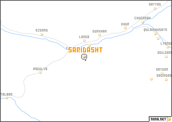
Saridasht ((( Kulyabskaya Oblast' )), Tajikistan)Saridasht is a town in the (( Kulyabskaya Oblast' )) region of Tajikistan. An overview map of the region around Saridasht is displayed below.
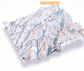
regional and 3d topo map of Saridasht, Tajikistan ::
Saridasht airports ::
The nearest airport is DYU - Dushanbe, located 147.1 km west of Saridasht.
Nearby towns ::
 Places with similar names to Saridasht, Tajikistan ::
// Sredishte (BG)
// Sredishte (BG)
// Sardasht (IQ)
// Sirdisht (IQ)
// Sarāy Dasht (IR)
// Sarāydasht (IR)
// Sar Dasht (IR)
// Sar Dasht (IR)
// Sar Dasht (IR)
// Sar Dasht (IR)
Disclaimer :: Information on this page comes without warranty of any kind |
||
|
Where is Saridasht? Elevation and coordinates ::
Latitude (lat): 38°40'24"N Longitude (lon): 70°30'20"E
Elevation (approx.): 1798m (map arrows pan, magnifying glasses zoom) |
||
|
Visiting Saridasht? Hotel/Accommodation ::
Book a hotel in Saridasht Travel Guide ::
Buy a travel guide for Tajikistan rental cars ::
car rental offers GPS waypoint ::
download a GPX waypoint (PoI) of Saridasht for your GPS receiver
|
||