|
search place name
|
||
Al Buşayrī (Ḩimş, Syria)Al Buşayrī is a town in the Ḩimş region of Syria. An overview map of the region around Al Buşayrī is displayed below.
regional and 3d topo map of Al Buşayrī, Syria ::

Al Buşayrī airports ::
The nearest airport is PMS - Palmyra, located 76.2 km north east of Al Buşayrī.
Other airports nearby include DAM - Damascus Intl (133.4 km south west), LTK - Latakia Bassel Al Assad Intl (208.6 km north west), OMF - Mafraq King Hussein (237.4 km south west), Nearby towns ::
[all distances 'as the bird flies' and approximate] 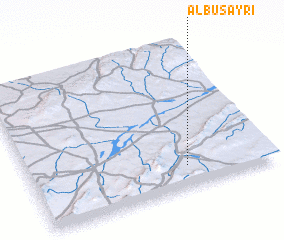 Places with similar names to Al Buşayrī, Syria ::
// Al Başrah (EG)
// Alibei-Ceair (RO)
// Al Buşayrah (SY)
// Alboussière (FR)
// ‘Alī Bāzār (IR)
// Al Buşayyir (QA)
// Al Başrah (IQ)
// Al Başar (SA)
// Al Başīrah (SA)
// Al Başīrī (SA)
Disclaimer :: Information on this page comes without warranty of any kind |
||
|
Where is Al Buşayrī? Elevation and coordinates ::
Latitude (lat): 34°9'0"N Longitude (lon): 37°39'0"E
Elevation (approx.): 805m (map arrows pan, magnifying glasses zoom) |
||
|
Visiting Al Buşayrī? Hotel/Accommodation ::
Book a hotel in Al Buşayrī Travel Guide ::
Buy a travel guide for Syria rental cars ::
car rental offers GPS waypoint ::
download a GPX waypoint (PoI) of Al Buşayrī for your GPS receiver
|
||