|
search place name
|
||
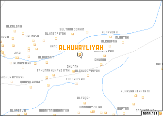
Al Ḩuwaylīyah (Al Ḩasakah, Syria)Al Ḩuwaylīyah is a town in the Al Ḩasakah region of Syria. An overview map of the region around Al Ḩuwaylīyah is displayed below.
regional and 3d topo map of Al Ḩuwaylīyah, Syria ::
Al Ḩuwaylīyah airports ::
The nearest airport is DEZ - Deire Zor Deir Zzor, located 126.6 km south west of Al Ḩuwaylīyah.
Other airports nearby include BAL - Batman (193.0 km north), DIY - Diyabakir Diyarbakir (202.7 km north), Nearby towns ::
At Turmānīyah (2.3km north east) //
Ghūnah (3.4km south west) //
Al Ghurayrīyah (4.3km south) //
Ghūnah (3.9km east) //
Ḩamdānīyah (4.3km north west) //
Umm Ḩajarah (4.3km east) //
Sulţān aḑ Ḑāhir (5.8km north) //
Al Bāshīyah (6.0km north) //
Tuffāḩīyah (6.1km south) //
Ḩuwayzīyah (6.1km south) //
Al Khūfah (5.9km north east) //
Al Maţ‘āfīyah (6.6km north west) //
Ţāḩūnah Ḩuwayzīyah (6.5km south west) //
Al Qurşāt (6.6km west) //
Al Fayḑah (7.2km north east) //
Shāhīn (7.9km south west) //
Mastūrah (8.0km north west) //
‘Alī ash Shāhīn (8.8km south west) //
[all distances 'as the bird flies' and approximate] 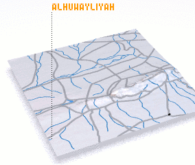 Places with similar names to Al Ḩuwaylīyah, Syria :: Disclaimer :: Information on this page comes without warranty of any kind |
||
|
Where is Al Ḩuwaylīyah? Elevation and coordinates ::
Latitude (lat): 36°11'29"N Longitude (lon): 41°1'37"E
Elevation (approx.): 384m (map arrows pan, magnifying glasses zoom) |
||
|
Visiting Al Ḩuwaylīyah? Hotel/Accommodation ::
Book a hotel in Al Ḩuwaylīyah Travel Guide ::
Buy a travel guide for Syria rental cars ::
car rental offers GPS waypoint ::
download a GPX waypoint (PoI) of Al Ḩuwaylīyah for your GPS receiver
|
||