|
search place name
|
||
Al Majwīyah (Ḩimş, Syria)Al Majwīyah is a town in the Ḩimş region of Syria. An overview map of the region around Al Majwīyah is displayed below.
regional and 3d topo map of Al Majwīyah, Syria ::

Al Majwīyah airports ::
The nearest airport is LTK - Latakia Bassel Al Assad Intl, located 107.0 km north of Al Majwīyah.
Other airports nearby include BEY - Beirut Rafic Hariri Intl (110.6 km south west), DAM - Damascus Intl (121.6 km south), PMS - Palmyra (179.2 km east), RPN - Rosh Pina Mahanaim I Ben Yaakov (183.9 km south west), Nearby towns ::
Akkūm (1.9km north) //
Marāḩ al ‘Arab (2.4km south west) //
Fīsān (2.4km south west) //
Şafāʼ aş Şafwah (3.1km east) //
Bayt ‘Alī (4.0km north) //
Al Bustān (3.6km north west) //
Al Ḩumayrah (3.6km north west) //
Akrūm (5.6km north) //
Ash Sharbīn (5.6km south) //
Wādī Ḩannā (4.9km east) //
Bâtech (4.9km east) //
Ar Ruwaymah (4.9km west) //
Blūzah (5.9km north east) //
Kafr Tūn (7.4km north) //
Marāḩ al Mashraf (7.4km south) //
Brayşah (7.2km south west) //
Al Quşayr (7.1km south east) //
Marāḩ ‘Abbās (8.7km south east) //
Ḩuwayk (8.3km north east) //
Summāqīyāt al Gharbīyah (9.6km north east) //
[all distances 'as the bird flies' and approximate] 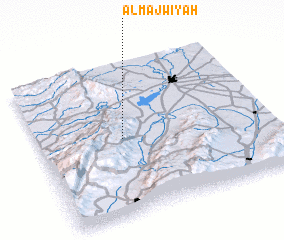 Places with similar names to Al Majwīyah, Syria :: Disclaimer :: Information on this page comes without warranty of any kind |
||
|
Where is Al Majwīyah? Elevation and coordinates ::
Latitude (lat): 34°30'0"N Longitude (lon): 36°22'0"E
Elevation (approx.): 1329m (map arrows pan, magnifying glasses zoom) |
||
|
Visiting Al Majwīyah? Hotel/Accommodation ::
Book a hotel in Al Majwīyah Travel Guide ::
Buy a travel guide for Syria rental cars ::
car rental offers GPS waypoint ::
download a GPX waypoint (PoI) of Al Majwīyah for your GPS receiver
|
||