|
search place name
|
||
‘Alūq al Gharbī (Al Ḩasakah, Syria)‘Alūq al Gharbī is a town in the Al Ḩasakah region of Syria. An overview map of the region around ‘Alūq al Gharbī is displayed below.
regional and 3d topo map of ‘Alūq al Gharbī, Syria ::

‘Alūq al Gharbī airports ::
The nearest airport is DIY - Diyabakir Diyarbakir, located 116.0 km north of ‘Alūq al Gharbī.
Other airports nearby include BAL - Batman (148.1 km north east), DEZ - Deire Zor Deir Zzor (173.7 km south), EZS - Elazig (208.6 km north), Nearby towns ::
‘Alūq ash Sharqī (0.0km north) //
Tchâhef (2.4km south east) //
Amuazam (4.0km north) //
Abū Ḩajar (3.5km south west) //
Dardārah (3.5km south east) //
Biʼr Nūḩ (5.6km south) //
Khirbat Ḩammūd (4.8km south east) //
Raʼs al ‘Ayn (5.8km west) //
Yukarıduraklı (7.4km north) //
Umm Şulaybah (6.2km east) //
Tall aş Şakhr (6.2km east) //
Altınharabesi (7.1km north east) //
Mujābirah (7.1km south east) //
Biʼr Rāzah (8.0km south) //
Jayqmah al Kabīrah (8.0km south) //
[all distances 'as the bird flies' and approximate] 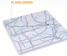 Places with similar names to ‘Alūq al Gharbī, Syria ::
// Al Kilḩ Gharb (EG)
Disclaimer :: Information on this page comes without warranty of any kind |
||
|
Where is ‘Alūq al Gharbī? Elevation and coordinates ::
Latitude (lat): 36°51'0"N Longitude (lon): 40°8'0"E
Elevation (approx.): 362m (map arrows pan, magnifying glasses zoom) |
||
|
Visiting ‘Alūq al Gharbī? Hotel/Accommodation ::
Book a hotel in ‘Alūq al Gharbī Travel Guide ::
Buy a travel guide for Syria rental cars ::
car rental offers GPS waypoint ::
download a GPX waypoint (PoI) of ‘Alūq al Gharbī for your GPS receiver
|
||