|
search place name
|
||
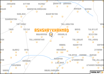
Ash Shaykh Aḩmad (Ḩalab, Syria)Ash Shaykh Aḩmad is a town in the Ḩalab region of Syria. An overview map of the region around Ash Shaykh Aḩmad is displayed below.
regional and 3d topo map of Ash Shaykh Aḩmad, Syria ::
Ash Shaykh Aḩmad airports ::
The nearest airport is ALP - Aleppo Intl, located 40.0 km north east of Ash Shaykh Aḩmad.
Other airports nearby include LTK - Latakia Bassel Al Assad Intl (104.3 km south west), GZT - Gaziantep Oguzeli (122.9 km north east), ADA - Adana Incirlik Ab (175.2 km north west), ADA - Adana (183.7 km north west), Nearby towns ::
Ijāz (1.4km south) //
Jubb Kaʼs (2.4km north west) //
Umm ‘Atabah (2.4km north east) //
Abū Kannsé (3.0km west) //
Kūsinīyā (3.0km east) //
Rasm al ‘Īs (3.0km east) //
Abbād (4.8km south east) //
Tall Karrāthīn (4.9km west) //
Rasm aş Şahārīj (4.9km east) //
Maḩārīm (5.8km south) //
Makhārīm (6.1km south east) //
Tall Hadīyah (5.8km north east) //
Khouâri (6.3km south east) //
Buwaybīyah (7.4km north) //
Khawārī (6.8km south east) //
Al Kusaybīyah (8.0km north) //
Ruşāfah (9.0km south) //
Talâfeh (9.5km south east) //
Jallās (10.3km south east) //
[all distances 'as the bird flies' and approximate] 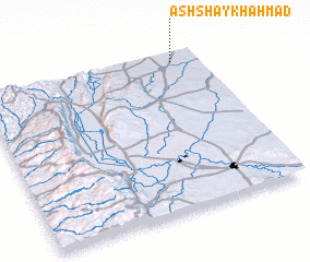 Places with similar names to Ash Shaykh Aḩmad, Syria ::
Disclaimer :: Information on this page comes without warranty of any kind |
||
|
Where is Ash Shaykh Aḩmad? Elevation and coordinates ::
Latitude (lat): 35°57'0"N Longitude (lon): 36°53'0"E
Elevation (approx.): 303m (map arrows pan, magnifying glasses zoom) |
||
|
Visiting Ash Shaykh Aḩmad? Hotel/Accommodation ::
Book a hotel in Ash Shaykh Aḩmad Travel Guide ::
Buy a travel guide for Syria rental cars ::
car rental offers GPS waypoint ::
download a GPX waypoint (PoI) of Ash Shaykh Aḩmad for your GPS receiver
|
||