|
search place name
|
||
As Sab‘ Jifār (Al Ḩasakah, Syria)As Sab‘ Jifār is a town in the Al Ḩasakah region of Syria. An overview map of the region around As Sab‘ Jifār is displayed below.
regional and 3d topo map of As Sab‘ Jifār, Syria ::

As Sab‘ Jifār airports ::
The nearest airport is BAL - Batman, located 137.0 km north west of As Sab‘ Jifār.
Other airports nearby include DIY - Diyabakir Diyarbakir (195.7 km north west), VAN - Van (200.7 km north east), DEZ - Deire Zor Deir Zzor (252.6 km south west), Nearby towns ::
TallḐayyiq (2.8km north) //
Aş Şihrīj al Gharbī (4.1km south) //
Khirbat ‘Izz ad Dīn (3.8km east) //
Tall adh Dhahab (4.0km north east) //
Tall Ghazāl (4.6km south west) //
Tall ‘Adas (5.5km north) //
Al ‘Ulyānīyah (6.4km south) //
Ḩamdān (7.1km north) //
Aş Şihrīj (7.1km south) //
As Sa‘īdah ‘Amqūn (6.3km north west) //
Kharāb Bunyān (6.1km west) //
Shuwayrah (6.9km north west) //
‘Arūr (7.6km north west) //
Kharāb Abū Ghālib aş Şubḩīyah (6.6km west) //
Al Khuwaytilah (8.4km south east) //
Khirbat ‘Abbās (8.1km north west) //
Al Mushayrifah (9.2km south east) //
Khirbat al Biʼr (10.8km south east) //
[all distances 'as the bird flies' and approximate] 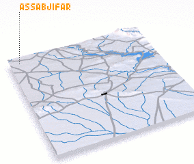 Places with similar names to As Sab‘ Jifār, Syria :: Disclaimer :: Information on this page comes without warranty of any kind |
||
|
Where is As Sab‘ Jifār? Elevation and coordinates ::
Latitude (lat): 36°57'37"N Longitude (lon): 42°4'35"E
Elevation (approx.): 447m (map arrows pan, magnifying glasses zoom) |
||
|
Visiting As Sab‘ Jifār? Hotel/Accommodation ::
Book a hotel in As Sab‘ Jifār Travel Guide ::
Buy a travel guide for Syria rental cars ::
car rental offers GPS waypoint ::
download a GPX waypoint (PoI) of As Sab‘ Jifār for your GPS receiver
|
||