|
search place name
|
||
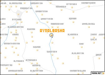
‘Ayn al Bāshā (Al Qunayţirah, Syria)‘Ayn al Bāshā is a town in the Al Qunayţirah region of Syria. An overview map of the region around ‘Ayn al Bāshā is displayed below.
regional and 3d topo map of ‘Ayn al Bāshā, Syria ::
‘Ayn al Bāshā airports ::
The nearest airport is RPN - Rosh Pina Mahanaim I Ben Yaakov, located 34.6 km west of ‘Ayn al Bāshā.
Other airports nearby include DAM - Damascus Intl (67.3 km north east), OMF - Mafraq King Hussein (82.8 km south), HFA - Haifa (87.4 km west), BEY - Beirut Rafic Hariri Intl (95.0 km north west), Nearby towns ::
Kawm ‘Ayn al Bāshā (1.9km south) //
Kammūnīyah (2.4km north west) //
Majdūlīyah (3.2km north west) //
Murāba‘āt (3.7km north) //
Nab‘ aş Şakhr (4.0km north) //
Umm at Tīnah (5.8km north) //
Suwaysah (6.2km south) //
Kudnaā (6.4km south west) //
Burayqah (6.1km west) //
Biʼr al ‘Ajam (6.2km west) //
Al Ḩārrah (6.2km east) //
Ruḩīnah (6.5km west) //
Al Quşaybah (7.6km south) //
Ruwayḩibah (7.0km north west) //
Umm Bāţinah (8.8km north) //
‘Aqrabā (8.3km north east) //
[all distances 'as the bird flies' and approximate] 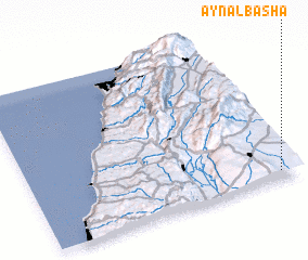 Places with similar names to ‘Ayn al Bāshā, Syria ::
// ‘Ayn al Bāshā (JO)
Disclaimer :: Information on this page comes without warranty of any kind |
||
|
Where is ‘Ayn al Bāshā? Elevation and coordinates ::
Latitude (lat): 33°3'0"N Longitude (lon): 35°56'0"E
Elevation (approx.): 772m (map arrows pan, magnifying glasses zoom) |
||
|
Visiting ‘Ayn al Bāshā? Hotel/Accommodation ::
Book a hotel in ‘Ayn al Bāshā Travel Guide ::
Buy a travel guide for Syria rental cars ::
car rental offers GPS waypoint ::
download a GPX waypoint (PoI) of ‘Ayn al Bāshā for your GPS receiver
|
||