|
search place name
|
||
‘Azīzī (Ḩalab, Syria)‘Azīzī is a town in the Ḩalab region of Syria. An overview map of the region around ‘Azīzī is displayed below.
regional and 3d topo map of ‘Azīzī, Syria ::
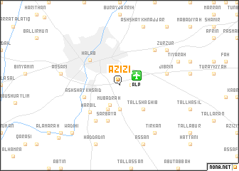
‘Azīzī airports ::
The nearest airport is ALP - Aleppo Intl, located 2.7 km north east of ‘Azīzī.
Other airports nearby include GZT - Gaziantep Oguzeli (90.1 km north), LTK - Latakia Bassel Al Assad Intl (141.5 km south west), ADA - Adana Incirlik Ab (183.9 km north west), ADA - Adana (194.2 km north west), Nearby towns ::
Nayrab (1.5km east) //
Mubadraḩ (3.3km south) //
Adh Dhahabīyah (3.7km south) //
Midraḩ (4.0km south) //
Tall Shaghīb (4.8km south east) //
Şarbāyā (5.8km south) //
Ash Shaykh Sa‘īd (4.9km west) //
Ḩalab (5.5km north west) //
Ḩarbīl (5.6km south west) //
Ḩuraybil (6.3km south west) //
Jibrīn (6.3km east) //
Duwayrīnah (6.3km east) //
Naqqārīn (7.1km north east) //
Tirkān (8.7km south east) //
Zurzūr (8.2km north east) //
Waḑīḩī (9.5km south west) //
[all distances 'as the bird flies' and approximate] 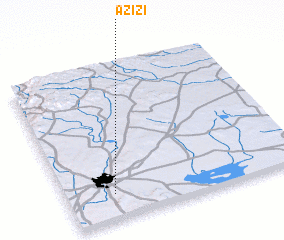 Places with similar names to ‘Azīzī, Syria ::
Disclaimer :: Information on this page comes without warranty of any kind |
||
|
Where is ‘Azīzī? Elevation and coordinates ::
Latitude (lat): 36°10'0"N Longitude (lon): 37°12'0"E
Elevation (approx.): 405m (map arrows pan, magnifying glasses zoom) |
||
|
Visiting ‘Azīzī? Hotel/Accommodation ::
Book a hotel in ‘Azīzī Travel Guide ::
Buy a travel guide for Syria rental cars ::
car rental offers GPS waypoint ::
download a GPX waypoint (PoI) of ‘Azīzī for your GPS receiver
|
||