|
search place name
|
||
Azraq (Ḩalab, Syria)Azraq is a town in the Ḩalab region of Syria. An overview map of the region around Azraq is displayed below.
regional and 3d topo map of Azraq, Syria ::

Azraq airports ::
The nearest airport is ALP - Aleppo Intl, located 28.9 km south west of Azraq.
Other airports nearby include GZT - Gaziantep Oguzeli (64.5 km north), LTK - Latakia Bassel Al Assad Intl (172.8 km south west), PMS - Palmyra (215.6 km south), Nearby towns ::
Brâta (1.9km north) //
Kufayr (1.5km west) //
Dāghilyāsh (1.8km south west) //
Ghūz (3.7km south) //
Wiqāḩ (3.8km north) //
Dānā (4.0km north) //
Ash Shaykh ‘Āqil (4.5km east) //
‘Uwaylīn (5.8km north) //
Darhla Bāsh (4.8km west) //
Qudayrān (5.8km north east) //
Ḩazwān (5.8km north west) //
Kharābishah (5.8km south west) //
Shamāwīyah (6.6km south east) //
Sha‘ālah (6.0km west) //
Al Bāb (6.1km east) //
Sūsiyān (7.6km north) //
Dayr Qāq (7.6km south) //
Ash Shaykh ‘Alwān (7.1km north west) //
Al Ḩadath (8.0km north) //
Abū Ţalţal (7.0km south east) //
Tall Raḩḩāl (7.0km south west) //
Sulaymah (8.7km south west) //
[all distances 'as the bird flies' and approximate] 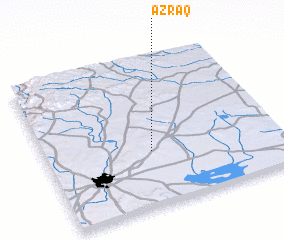 Places with similar names to Azraq, Syria ::
Disclaimer :: Information on this page comes without warranty of any kind |
||
|
Where is Azraq? Elevation and coordinates ::
Latitude (lat): 36°22'0"N Longitude (lon): 37°27'0"E
Elevation (approx.): 507m (map arrows pan, magnifying glasses zoom) |
||
|
Visiting Azraq? Hotel/Accommodation ::
Book a hotel in Azraq Travel Guide ::
Buy a travel guide for Syria rental cars ::
car rental offers GPS waypoint ::
download a GPX waypoint (PoI) of Azraq for your GPS receiver
|
||