|
search place name
|
||
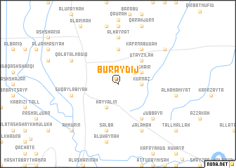
Buraydīj (Ḩamāh, Syria)Buraydīj is a town in the Ḩamāh region of Syria. An overview map of the region around Buraydīj is displayed below.
regional and 3d topo map of Buraydīj, Syria ::
Buraydīj airports ::
The nearest airport is LTK - Latakia Bassel Al Assad Intl, located 45.6 km west of Buraydīj.
Other airports nearby include ALP - Aleppo Intl (112.8 km north east), PMS - Palmyra (193.5 km south east), BEY - Beirut Rafic Hariri Intl (194.5 km south west), GZT - Gaziantep Oguzeli (196.7 km north east), Nearby towns ::
Al Muqayr (2.9km north east) //
Kurnāz (3.0km east) //
Ḩayyālīn (4.0km south) //
Maghāʼir (3.5km north east) //
‘Utayzilah (4.8km north east) //
Al Ḩawāsh (5.6km north) //
Ash Shaykh Ḩadīd (6.3km south east) //
Kafr Nabūdah (6.3km north east) //
Al Ḩayrāt (7.4km north) //
Şalbā (7.6km south) //
Şuqaylabīyah (6.3km west) //
Jubbayn (7.2km south east) //
Jalamah (8.0km south) //
Qal‘at al Maḑīq (7.1km north west) //
Al Habīţ (8.2km north east) //
‘Ammūrīn (9.6km south west) //
[all distances 'as the bird flies' and approximate]  Places with similar names to Buraydīj, Syria ::
Disclaimer :: Information on this page comes without warranty of any kind |
||
|
Where is Buraydīj? Elevation and coordinates ::
Latitude (lat): 35°23'0"N Longitude (lon): 36°27'0"E
Elevation (approx.): 275m (map arrows pan, magnifying glasses zoom) |
||
|
Visiting Buraydīj? Hotel/Accommodation ::
Book a hotel in Buraydīj Travel Guide ::
Buy a travel guide for Syria rental cars ::
car rental offers GPS waypoint ::
download a GPX waypoint (PoI) of Buraydīj for your GPS receiver
|
||