|
search place name
|
||
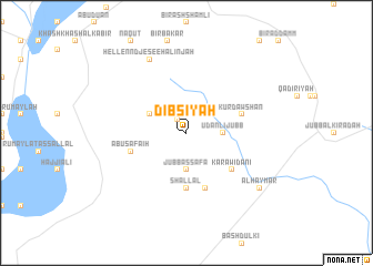
Dibsīyah (Ḩalab, Syria)Dibsīyah is a town in the Ḩalab region of Syria. An overview map of the region around Dibsīyah is displayed below.
regional and 3d topo map of Dibsīyah, Syria ::
Dibsīyah airports ::
The nearest airport is ALP - Aleppo Intl, located 100.8 km west of Dibsīyah.
Other airports nearby include GZT - Gaziantep Oguzeli (103.6 km north west), PMS - Palmyra (195.2 km south), DEZ - Deire Zor Deir Zzor (202.1 km south east), DIY - Diyabakir Diyarbakir (241.2 km north east), Nearby towns ::
Dablīsīyah (1.6km north west) //
Jubb aş Şafā (3.7km south) //
Ūdanlī Jubb (3.0km east) //
Biʼr al A‘má (3.5km north west) //
Shallāl (5.6km south) //
Kūr Dawshān (4.8km east) //
Kūr Udānī (5.8km south) //
Abū Şafāʼiḩ (4.8km west) //
Karāwiḑānī (5.3km south east) //
Hellenndjé see Ḩalinjah (8.0km north) //
Ḩalinjah (8.0km north) //
Al Ḩaymar (8.2km south east) //
[all distances 'as the bird flies' and approximate]  Places with similar names to Dibsīyah, Syria ::
Disclaimer :: Information on this page comes without warranty of any kind |
||
|
Where is Dibsīyah? Elevation and coordinates ::
Latitude (lat): 36°19'0"N Longitude (lon): 38°20'0"E
Elevation (approx.): 524m (map arrows pan, magnifying glasses zoom) |
||
|
Visiting Dibsīyah? Hotel/Accommodation ::
Book a hotel in Dibsīyah Travel Guide ::
Buy a travel guide for Syria rental cars ::
car rental offers GPS waypoint ::
download a GPX waypoint (PoI) of Dibsīyah for your GPS receiver
|
||