|
search place name
|
||
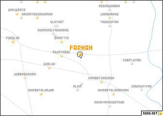
Farḩah (Ḩimş, Syria)Farḩah is a town in the Ḩimş region of Syria. An overview map of the region around Farḩah is displayed below.
regional and 3d topo map of Farḩah, Syria ::
Farḩah airports ::
The nearest airport is PMS - Palmyra, located 100.2 km east of Farḩah.
Other airports nearby include DAM - Damascus Intl (144.1 km south west), LTK - Latakia Bassel Al Assad Intl (148.8 km north west), ALP - Aleppo Intl (179.1 km north), BEY - Beirut Rafic Hariri Intl (180.2 km south west), Nearby towns ::
Rujm Ţuqqū (3.8km west) //
Umm at Tīn (5.3km north west) //
Al Būlīyah (6.0km south) //
Khirbat Daghash (6.7km south east) //
‘Alwīn (7.5km south) //
Ghalwā (6.5km west) //
Mat‘ab (7.1km north west) //
Murrān al Fawwārah (7.7km north west) //
‘Ulaymāt (8.7km north west) //
‘Awāyid (8.9km north west) //
Tadmurīyah (9.1km north east) //
Khirbat al ‘Arāminah (10.3km south east) //
[all distances 'as the bird flies' and approximate] 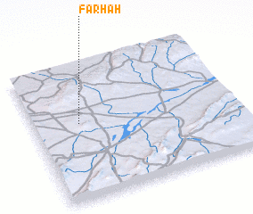 Places with similar names to Farḩah, Syria ::
Disclaimer :: Information on this page comes without warranty of any kind |
||
|
Where is Farḩah? Elevation and coordinates ::
Latitude (lat): 34°34'0"N Longitude (lon): 37°13'30"E
Elevation (approx.): 699m (map arrows pan, magnifying glasses zoom) |
||
|
Visiting Farḩah? Hotel/Accommodation ::
Book a hotel in Farḩah Travel Guide ::
Buy a travel guide for Syria rental cars ::
car rental offers GPS waypoint ::
download a GPX waypoint (PoI) of Farḩah for your GPS receiver
|
||