|
search place name
|
||
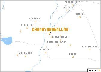
Ghurayb ‘Abdallāh (Ar Raqqah, Syria)Ghurayb ‘Abdallāh is a town in the Ar Raqqah region of Syria. An overview map of the region around Ghurayb ‘Abdallāh is displayed below.
regional and 3d topo map of Ghurayb ‘Abdallāh, Syria ::
Ghurayb ‘Abdallāh airports ::
The nearest airport is DEZ - Deire Zor Deir Zzor, located 85.8 km south east of Ghurayb ‘Abdallāh.
Other airports nearby include PMS - Palmyra (202.9 km south west), DIY - Diyabakir Diyarbakir (217.6 km north), BAL - Batman (249.9 km north east), Nearby towns ::
‘Abd al Matnī (0.7km south) //
Julayb Khalīl (2.6km north east) //
Sahrān (3.0km east) //
Ḩusayn Ḩamādah (3.4km south east) //
‘Alī Badr (3.5km north west) //
Muḩammad al ‘Ayyāsh (4.1km south east) //
Mūtūr ‘Ayfān (6.4km south) //
Askhāmīyah (6.9km north west) //
Ţuhmāz al Wāwī (6.9km south east) //
Abū Ḩabbah (7.6km north west) //
Rawḑah (10.3km south east) //
[all distances 'as the bird flies' and approximate] 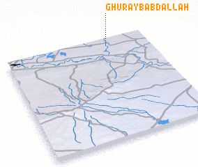 Places with similar names to Ghurayb ‘Abdallāh, Syria :: Disclaimer :: Information on this page comes without warranty of any kind |
||
|
Where is Ghurayb ‘Abdallāh? Elevation and coordinates ::
Latitude (lat): 35°58'10"N Longitude (lon): 39°44'0"E
Elevation (approx.): 310m (map arrows pan, magnifying glasses zoom) |
||
|
Visiting Ghurayb ‘Abdallāh? Hotel/Accommodation ::
Book a hotel in Ghurayb ‘Abdallāh Travel Guide ::
Buy a travel guide for Syria rental cars ::
car rental offers GPS waypoint ::
download a GPX waypoint (PoI) of Ghurayb ‘Abdallāh for your GPS receiver
|
||