|
search place name
|
||
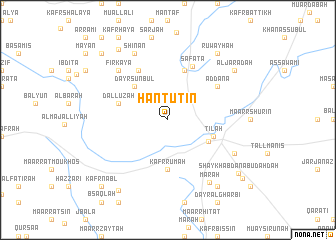
Ḩantūtīn (Idlib, Syria)Ḩantūtīn is a town in the Idlib region of Syria. An overview map of the region around Ḩantūtīn is displayed below.
regional and 3d topo map of Ḩantūtīn, Syria ::
Ḩantūtīn airports ::
The nearest airport is LTK - Latakia Bassel Al Assad Intl, located 68.7 km south west of Ḩantūtīn.
Other airports nearby include ALP - Aleppo Intl (78.1 km north east), GZT - Gaziantep Oguzeli (161.1 km north east), ADA - Adana Incirlik Ab (183.6 km north west), ADA - Adana (189.9 km north west), Nearby towns ::
Ma‘arrat an Nu‘mān (4.4km south east) //
Dayr Sunbul (4.8km north west) //
Til‘ah (4.5km south east) //
Kafr Rūmah (5.6km south) //
Dallūzah (4.9km west) //
Banīn (5.8km north) //
Farkīyā (6.2km north west) //
Safātā (6.4km north) //
Ad Dānā (5.8km north east) //
Firkayā (7.2km north west) //
Shinān (8.0km north) //
Ma‘arr Shamshah (7.1km south east) //
Marāḩ (7.9km south east) //
Ruwayḩah (8.7km north east) //
Dār Ma‘arrāt (8.7km south east) //
Al Jarādah (8.2km north east) //
Mur‘abān (9.1km north west) //
Basqalā (9.1km south west) //
Shaykh ‘Abdān Abu Daḩdaḩ (8.8km south east) //
Maghārah (9.5km north west) //
Kafr Nabl (9.6km south west) //
Ma‘rātah (9.4km south east) //
[all distances 'as the bird flies' and approximate] 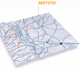 Places with similar names to Ḩantūtīn, Syria ::
// Hanatetena (PF)
Disclaimer :: Information on this page comes without warranty of any kind |
||
|
Where is Ḩantūtīn? Elevation and coordinates ::
Latitude (lat): 35°40'0"N Longitude (lon): 36°38'0"E
Elevation (approx.): 580m (map arrows pan, magnifying glasses zoom) |
||
|
Visiting Ḩantūtīn? Hotel/Accommodation ::
Book a hotel in Ḩantūtīn Travel Guide ::
Buy a travel guide for Syria rental cars ::
car rental offers GPS waypoint ::
download a GPX waypoint (PoI) of Ḩantūtīn for your GPS receiver
|
||