|
search place name
|
||
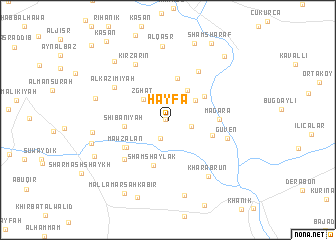
Ḩayfā (Al Ḩasakah, Syria)Ḩayfā is a town in the Al Ḩasakah region of Syria. An overview map of the region around Ḩayfā is displayed below.
regional and 3d topo map of Ḩayfā, Syria ::
Ḩayfā airports ::
The nearest airport is BAL - Batman, located 134.8 km north west of Ḩayfā.
Other airports nearby include VAN - Van (172.0 km north east), Nearby towns ::
Kharāb Rakkābah (0.3km west) //
Tall Lūn (2.1km south) //
Zuhayrah (2.1km east) //
An Namūrajīyah (2.8km north) //
Zghāt (3.2km north west) //
Az Zahrīyah at Taḩtānīyah (3.2km north east) //
Al Aḩmadīyah (3.7km north east) //
Shamāsīyah (4.8km north) //
Bostancı (4.2km north east) //
Shībānīyah (3.9km west) //
Kharāb Rashak (4.2km south east) //
Shām Shaylak (5.2km south) //
Mawzālān (4.8km south west) //
Mağara (4.6km east) //
Al Hāmah (4.9km south west) //
Qarah Kharāb (6.1km north east) //
Ḩājjī Hārūn (5.8km south west) //
Güven (5.6km east) //
Al Kāz̧imīyah (6.0km north west) //
Kīr Zārīn (6.9km north west) //
Kharāb Rūn (7.1km south east) //
Al Qaşr (8.3km north) //
Al Ḩākimīyah (6.9km west) //
Tall al Umarāʼ (6.8km west) //
Al Marj al Akhḑar (8.5km south) //
Kīrak (7.3km west) //
‘Ayn Wark (8.2km north west) //
Mazra‘at ash Shāţiʼ (8.9km north) //
Ar Rashīdīyah (7.7km south west) //
[all distances 'as the bird flies' and approximate] 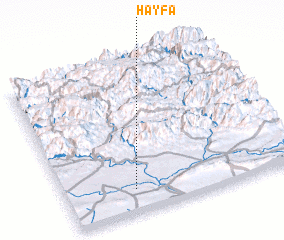 Places with similar names to Ḩayfā, Syria ::
Disclaimer :: Information on this page comes without warranty of any kind |
||
|
Where is Ḩayfā? Elevation and coordinates ::
Latitude (lat): 37°9'21"N Longitude (lon): 42°17'37"E
Elevation (approx.): 365m (map arrows pan, magnifying glasses zoom) |
||
|
Visiting Ḩayfā? Hotel/Accommodation ::
Book a hotel in Ḩayfā Travel Guide ::
Buy a travel guide for Syria rental cars ::
car rental offers GPS waypoint ::
download a GPX waypoint (PoI) of Ḩayfā for your GPS receiver
|
||