|
search place name
|
||
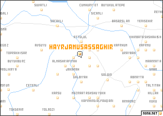
Ḩayr Jāmūs aş Şaghīr (Idlib, Syria)Ḩayr Jāmūs aş Şaghīr is a town in the Idlib region of Syria. An overview map of the region around Ḩayr Jāmūs aş Şaghīr is displayed below.
regional and 3d topo map of Ḩayr Jāmūs aş Şaghīr, Syria ::
Ḩayr Jāmūs aş Şaghīr airports ::
The nearest airport is ALP - Aleppo Intl, located 74.2 km east of Ḩayr Jāmūs aş Şaghīr.
Other airports nearby include LTK - Latakia Bassel Al Assad Intl (95.9 km south west), ADA - Adana Incirlik Ab (125.9 km north west), GZT - Gaziantep Oguzeli (128.5 km north east), ADA - Adana (133.8 km north west), Nearby towns ::
Ḩayr Jāmūs al Kabīr (1.5km east) //
Jisr al Maksūr (1.5km west) //
Bazintā (2.4km south east) //
‘Allānī (2.4km south west) //
Judaydah (2.4km north east) //
At Tulūl (3.7km north) //
Al Mashrafīyah (3.5km south west) //
‘Uwayrah ash Sharqīyah (3.5km south east) //
Kafrinnah (3.5km north east) //
Jakārah (4.0km south) //
Dalbīyah (5.6km south) //
Kıyıgören (5.8km south west) //
Salqīn (7.1km south east) //
Saçaklı (8.7km north west) //
Madenboyu (8.8km north west) //
[all distances 'as the bird flies' and approximate] 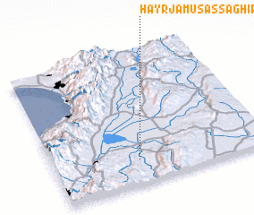 Places with similar names to Ḩayr Jāmūs aş Şaghīr, Syria :: Disclaimer :: Information on this page comes without warranty of any kind |
||
|
Where is Ḩayr Jāmūs aş Şaghīr? Elevation and coordinates ::
Latitude (lat): 36°11'0"N Longitude (lon): 36°24'0"E
Elevation (approx.): 109m (map arrows pan, magnifying glasses zoom) |
||
|
Visiting Ḩayr Jāmūs aş Şaghīr? Hotel/Accommodation ::
Book a hotel in Ḩayr Jāmūs aş Şaghīr Travel Guide ::
Buy a travel guide for Syria rental cars ::
car rental offers GPS waypoint ::
download a GPX waypoint (PoI) of Ḩayr Jāmūs aş Şaghīr for your GPS receiver
|
||