|
search place name
|
||
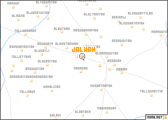
Jalwah (Al Ḩasakah, Syria)Jalwah is a town in the Al Ḩasakah region of Syria. An overview map of the region around Jalwah is displayed below.
regional and 3d topo map of Jalwah, Syria ::
Jalwah airports ::
The nearest airport is BAL - Batman, located 147.1 km north west of Jalwah.
Other airports nearby include DIY - Diyabakir Diyarbakir (201.0 km north west), VAN - Van (215.8 km north east), DEZ - Deire Zor Deir Zzor (238.7 km south west), Nearby towns ::
Diyābah (1.4km north west) //
‘Uqaylīyah (2.5km north east) //
Mas‘adah (2.8km south) //
Al Ya‘rūbīyah (3.2km south east) //
Tall Kūjik (3.2km south east) //
Al Mustarīḩah (4.1km north west) //
Al Maḩmūdīyah (4.2km east) //
Mas‘ūd ar Rafī‘ah (5.7km north) //
Al Mushayrafah aş Şaghīrah (5.0km south east) //
Şaydah (5.9km north east) //
As Sa‘dah (5.6km east) //
Mushayrafah (7.4km south east) //
Al Būthah (7.3km north west) //
Al Ḩurrīyah (6.7km west) //
Rabī‘ah (7.3km south east) //
Ad Duwaym (7.4km west) //
Aş Şadīdīyah (7.6km north east) //
Umm al ‘Iz̧ām (9.0km south west) //
Aş Şihrīj (10.6km north east) //
[all distances 'as the bird flies' and approximate] 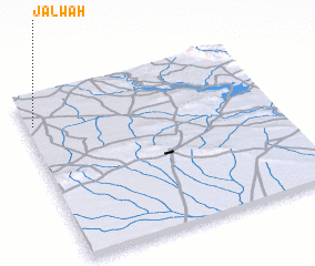 Places with similar names to Jalwah, Syria ::
Disclaimer :: Information on this page comes without warranty of any kind |
||
|
Where is Jalwah? Elevation and coordinates ::
Latitude (lat): 36°49'20"N Longitude (lon): 42°1'50"E
Elevation (approx.): 394m (map arrows pan, magnifying glasses zoom) |
||
|
Visiting Jalwah? Hotel/Accommodation ::
Book a hotel in Jalwah Travel Guide ::
Buy a travel guide for Syria rental cars ::
car rental offers GPS waypoint ::
download a GPX waypoint (PoI) of Jalwah for your GPS receiver
|
||