|
search place name
|
||
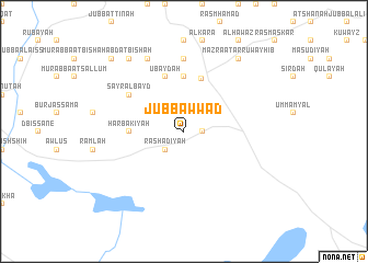
Jubb ‘Awwād (Ḩalab, Syria)Jubb ‘Awwād is a town in the Ḩalab region of Syria. An overview map of the region around Jubb ‘Awwād is displayed below.
regional and 3d topo map of Jubb ‘Awwād, Syria ::
Jubb ‘Awwād airports ::
The nearest airport is ALP - Aleppo Intl, located 54.9 km north west of Jubb ‘Awwād.
Other airports nearby include GZT - Gaziantep Oguzeli (134.7 km north), LTK - Latakia Bassel Al Assad Intl (143.9 km west), PMS - Palmyra (151.0 km south east), BEY - Beirut Rafic Hariri Intl (279.9 km south west), Nearby towns ::
Qirbātīyah (1.5km east) //
Rashādīyah (2.4km south west) //
Ar Rubayl (2.4km south west) //
Ḩijārah al Kabīrah (2.4km north west) //
Al Mushayrifah (3.5km north west) //
Ḩijārah aş Şaghīrah (3.5km north west) //
Ḩarbakīyah (4.5km west) //
Khanāşir (5.6km north) //
Mughayrāt (5.5km north) //
‘Ubaydah (5.8km north) //
Sayr al Bayḑ (5.8km north west) //
Ḩarbaţīyah (7.4km north) //
Jubb Qāsim (8.0km north) //
‘Abdat Bīshah (8.7km north west) //
Mazra‘at ar Ruwayhib (8.7km north east) //
Bīshah (9.5km north west) //
[all distances 'as the bird flies' and approximate] 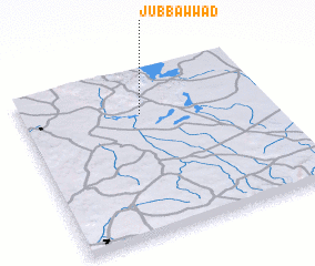 Places with similar names to Jubb ‘Awwād, Syria ::
Disclaimer :: Information on this page comes without warranty of any kind |
||
|
Where is Jubb ‘Awwād? Elevation and coordinates ::
Latitude (lat): 35°44'0"N Longitude (lon): 37°29'0"E
Elevation (approx.): 417m (map arrows pan, magnifying glasses zoom) |
||
|
Visiting Jubb ‘Awwād? Hotel/Accommodation ::
Book a hotel in Jubb ‘Awwād Travel Guide ::
Buy a travel guide for Syria rental cars ::
car rental offers GPS waypoint ::
download a GPX waypoint (PoI) of Jubb ‘Awwād for your GPS receiver
|
||