|
search place name
|
||
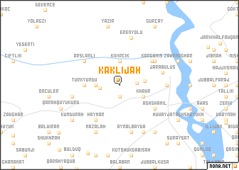
Kaklījah (Ḩalab, Syria)Kaklījah is a town in the Ḩalab region of Syria. An overview map of the region around Kaklījah is displayed below.
regional and 3d topo map of Kaklījah, Syria ::
Kaklījah airports ::
The nearest airport is GZT - Gaziantep Oguzeli, located 45.1 km west of Kaklījah.
Other airports nearby include ALP - Aleppo Intl (94.6 km south west), MLX - Malatya Erhac (181.9 km north), EZS - Elazig (232.8 km north east), Nearby towns ::
Tall ash Sha‘īr (1.9km south) //
Ţāsh Atān (1.9km south) //
Al Ḩajalīyah (2.2km east) //
Al Ḩilwānīyah (2.5km west) //
Kıvırcık (3.7km north) //
Dūknuk (3.0km west) //
Marmá al Ḩajar (3.3km east) //
Khawr (3.5km south east) //
Türkyurdu (4.5km west) //
Kargamış (5.5km north east) //
Ash Shāmil (5.8km south east) //
Maylīk (5.8km north east) //
Ḩaymar (6.3km south west) //
Arslanlı (5.8km north west) //
Jarābulus (5.8km east) //
Jarābulus at Taḩtānī (5.9km east) //
‘Ayn al Bayḑāʼ (7.6km south) //
Erenyolu (7.6km north) //
Qarah Qūyū ‘Arab (6.2km west) //
Muflis (8.0km south) //
Maz‘alah (8.0km south) //
Yūsuf Bayk (8.0km south) //
‘Amārinah (8.6km south east) //
Kundurah (8.1km south west) //
[all distances 'as the bird flies' and approximate]  Places with similar names to Kaklījah, Syria ::
Disclaimer :: Information on this page comes without warranty of any kind |
||
|
Where is Kaklījah? Elevation and coordinates ::
Latitude (lat): 36°48'0"N Longitude (lon): 37°57'0"E
Elevation (approx.): 461m (map arrows pan, magnifying glasses zoom) |
||
|
Visiting Kaklījah? Hotel/Accommodation ::
Book a hotel in Kaklījah Travel Guide ::
Buy a travel guide for Syria rental cars ::
car rental offers GPS waypoint ::
download a GPX waypoint (PoI) of Kaklījah for your GPS receiver
|
||