|
search place name
|
||
Khaţţāb (Ḩamāh, Syria)Khaţţāb is a town in the Ḩamāh region of Syria. An overview map of the region around Khaţţāb is displayed below.
regional and 3d topo map of Khaţţāb, Syria ::

Khaţţāb airports ::
The nearest airport is PMS - Palmyra, located 99.0 km south east of Khaţţāb.
Other airports nearby include LTK - Latakia Bassel Al Assad Intl (136.6 km north west), ALP - Aleppo Intl (141.0 km north), DAM - Damascus Intl (182.6 km south west), BEY - Beirut Rafic Hariri Intl (207.8 km south west), Nearby towns ::
Ţarfāwī (0.9km north east) //
Abū Ţabābīr (0.9km north west) //
Mushayrifah ash Shamālīyah (1.6km south east) //
Ţarfāwī (1.6km south east) //
Abū al Balāyah (2.4km north) //
‘Uşmūd (2.3km west) //
Aş Şāliḩīyah (2.7km south east) //
Ad Duwaybah (2.7km south east) //
‘Aşmūd (2.7km north west) //
Abū al ‘Alāyā (3.3km north) //
Salām al Gharbī (4.2km north) //
Umm Ḩāratayn ash Sharqīyah (4.0km south west) //
Salām ash Sharqī (4.8km north east) //
Musay‘īd (5.2km south) //
Musay‘īd (5.2km south) //
Mas‘adah (5.0km south east) //
Mas‘ūdīyah (5.6km south west) //
Umm Ḩāratayn al Gharbīyah (5.5km west) //
Khaţamlū (6.4km north) //
Khirbat Qāsim (6.4km north) //
Kurayzū (6.4km south east) //
Mushayrifat ash Shamālīyah (7.0km south) //
Umm ar Rīsh (6.2km south east) //
Barghūtīyah (6.8km north west) //
‘Arshūnah (7.1km north west) //
Umm Tuwaynah ash Shamālīyah (6.8km north east) //
Burghūthīyah (6.8km north west) //
Kharījīyah (7.9km north) //
Tall al Jadīd (6.9km west) //
[all distances 'as the bird flies' and approximate] 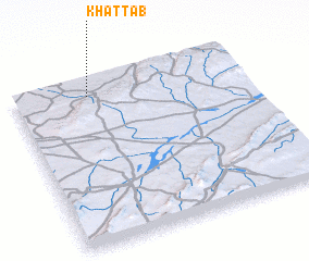 Places with similar names to Khaţţāb, Syria ::
Disclaimer :: Information on this page comes without warranty of any kind |
||
|
Where is Khaţţāb? Elevation and coordinates ::
Latitude (lat): 34°54'45"N Longitude (lon): 37°19'30"E
Elevation (approx.): 708m (map arrows pan, magnifying glasses zoom) |
||
|
Visiting Khaţţāb? Hotel/Accommodation ::
Book a hotel in Khaţţāb Travel Guide ::
Buy a travel guide for Syria rental cars ::
car rental offers GPS waypoint ::
download a GPX waypoint (PoI) of Khaţţāb for your GPS receiver
|
||