|
search place name
|
||
Khirbat ‘Azīm (Al Ḩasakah, Syria)Khirbat ‘Azīm is a town in the Al Ḩasakah region of Syria. An overview map of the region around Khirbat ‘Azīm is displayed below.
regional and 3d topo map of Khirbat ‘Azīm, Syria ::

Khirbat ‘Azīm airports ::
The nearest airport is BAL - Batman, located 138.8 km north of Khirbat ‘Azīm.
Other airports nearby include DIY - Diyabakir Diyarbakir (138.9 km north), DEZ - Deire Zor Deir Zzor (166.6 km south), EZS - Elazig (245.4 km north west), Nearby towns ::
Tall Bāţī (1.5km west) //
Muqbilah (2.4km north east) //
Khirbat ‘Āshūr (3.7km north) //
Sa‘dīyah (3.5km north west) //
Tall ash Shaykh Amīn (4.0km north) //
Khirbat al Khūş (4.0km north) //
Sa‘dīyah (4.0km south) //
Mūrak al Fawqānī (3.5km south east) //
Birkīl Bawz (4.4km south west) //
Chamma (4.8km north east) //
Mūrak at Taḩtānī (6.3km south east) //
Fāţimah (6.3km north east) //
Tall Ḩimar (7.4km north) //
‘Āqūlah (7.6km north) //
Sīḩah Mayshīyah (7.6km north) //
Şāliḩīyah (6.2km east) //
Tall Afandī (7.1km north west) //
Rāghū (7.0km north west) //
Nāʼif (8.0km north) //
‘Antarīyah (7.0km south east) //
Kawlah (8.3km south east) //
Rujūbat al Furs (8.8km south west) //
[all distances 'as the bird flies' and approximate] 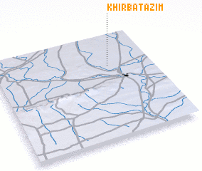 Places with similar names to Khirbat ‘Azīm, Syria ::
// Khirbat ‘Uşaym (JO)
Disclaimer :: Information on this page comes without warranty of any kind |
||
|
Where is Khirbat ‘Azīm? Elevation and coordinates ::
Latitude (lat): 36°43'0"N Longitude (lon): 40°44'0"E
Elevation (approx.): 352m (map arrows pan, magnifying glasses zoom) |
||
|
Visiting Khirbat ‘Azīm? Hotel/Accommodation ::
Book a hotel in Khirbat ‘Azīm Travel Guide ::
Buy a travel guide for Syria rental cars ::
car rental offers GPS waypoint ::
download a GPX waypoint (PoI) of Khirbat ‘Azīm for your GPS receiver
|
||