|
search place name
|
||
Kīr Ballak (Ḩalab, Syria)Kīr Ballak is a town in the Ḩalab region of Syria. An overview map of the region around Kīr Ballak is displayed below.
regional and 3d topo map of Kīr Ballak, Syria ::

Kīr Ballak airports ::
The nearest airport is GZT - Gaziantep Oguzeli, located 98.5 km west of Kīr Ballak.
Other airports nearby include ALP - Aleppo Intl (133.7 km south west), MLX - Malatya Erhac (193.2 km north), DIY - Diyabakir Diyarbakir (195.0 km north east), DEZ - Deire Zor Deir Zzor (217.5 km south east), Nearby towns ::
Karbalak (0.2km east) //
Laḩīnah (1.9km south) //
Biʼr ‘Umar (1.5km east) //
Taḩtīk Fawqānī (1.8km south west) //
Taḩtīk Taḩtānī (2.3km south) //
Qawjaq (2.6km west) //
Kawjak (3.5km south) //
Qutshik (3.0km west) //
Tall al Aghbar Fawqānī (3.6km south west) //
Bawz Huyūk at Taḩtānī (4.0km south) //
Hūlāqī (4.0km north) //
Īt Wīrān at Taḩtānī (4.0km north) //
Tall al Ḩajar Taḩtānī (4.1km north west) //
Aytuwayrān Taḩtānī (4.3km north east) //
Sirr Yaḩūr (4.0km south west) //
Bawz Huyūk al Fawqānī (4.8km south west) //
Bawz Huyūk al Fawqānī (4.8km south west) //
Dār as Salām (4.8km south west) //
Ţāshlī Huyūk at Taḩtānī (4.7km north west) //
Kharāb Rassett (4.5km west) //
Dībrak Shaykhān (5.6km south) //
Sūlān (4.5km east) //
Hawlāqī (5.7km north) //
Surayḩūr (4.8km south west) //
Yīrāllī (5.8km south) //
Biʼr Kannah (5.8km south east) //
Īt Wīrān al Fawqānī (6.3km north east) //
Aytuwayrān Fawqānī (6.7km north east) //
Kharāb Şārūnj (7.6km south) //
[all distances 'as the bird flies' and approximate] 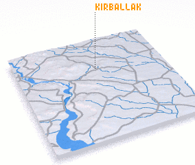 Places with similar names to Kīr Ballak, Syria ::
Disclaimer :: Information on this page comes without warranty of any kind |
||
|
Where is Kīr Ballak? Elevation and coordinates ::
Latitude (lat): 36°44'0"N Longitude (lon): 38°33'0"E
Elevation (approx.): 462m (map arrows pan, magnifying glasses zoom) |
||
|
Visiting Kīr Ballak? Hotel/Accommodation ::
Book a hotel in Kīr Ballak Travel Guide ::
Buy a travel guide for Syria rental cars ::
car rental offers GPS waypoint ::
download a GPX waypoint (PoI) of Kīr Ballak for your GPS receiver
|
||