|
search place name
|
||
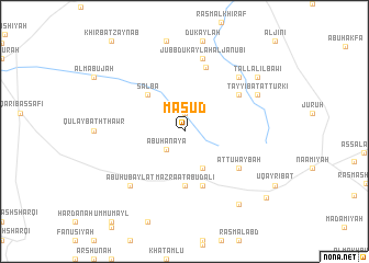
Mas‘ūd (Ḩamāh, Syria)Mas‘ūd is a town in the Ḩamāh region of Syria. An overview map of the region around Mas‘ūd is displayed below.
regional and 3d topo map of Mas‘ūd, Syria ::
Mas‘ūd airports ::
The nearest airport is PMS - Palmyra, located 104.7 km south east of Mas‘ūd.
Other airports nearby include ALP - Aleppo Intl (122.4 km north), LTK - Latakia Bassel Al Assad Intl (133.8 km west), DAM - Damascus Intl (201.5 km south west), GZT - Gaziantep Oguzeli (207.1 km north), Nearby towns ::
Mas‘adah (1.9km north) //
Abū Ḩanāyā (2.4km south west) //
Abū Rimāl (4.0km south) //
Salba (4.8km north west) //
Mazra‘at Abū Dālī (5.6km south) //
Abū Dālī (5.8km south) //
Aţ Ţuwaybah (5.9km south east) //
Al Marāmī (5.9km south east) //
Mukaymin al Qiblī (5.9km north east) //
Şalbīyah (6.7km north) //
Jubb Dukaylah al Janūbī (7.6km north) //
Mukaymin ash Shamālī (7.2km north east) //
Abū Ḩubaylāt (7.2km south west) //
Ţayyibat at Turkī (7.1km north east) //
Kawkab as Suwayd (8.7km south east) //
Tall al ‘Ilbāwī (8.2km north east) //
Ḩamādat al ‘Amr (9.6km south east) //
[all distances 'as the bird flies' and approximate] 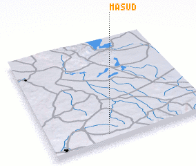 Places with similar names to Mas‘ūd, Syria ::
Disclaimer :: Information on this page comes without warranty of any kind |
||
|
Where is Mas‘ūd? Elevation and coordinates ::
Latitude (lat): 35°5'0"N Longitude (lon): 37°22'0"E
Elevation (approx.): 619m (map arrows pan, magnifying glasses zoom) |
||
|
Visiting Mas‘ūd? Hotel/Accommodation ::
Book a hotel in Mas‘ūd Travel Guide ::
Buy a travel guide for Syria rental cars ::
car rental offers GPS waypoint ::
download a GPX waypoint (PoI) of Mas‘ūd for your GPS receiver
|
||