|
search place name
|
||
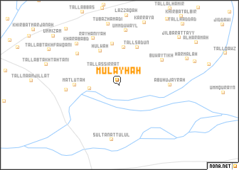
Mulayḩah (Al Ḩasakah, Syria)Mulayḩah is a town in the Al Ḩasakah region of Syria. An overview map of the region around Mulayḩah is displayed below.
regional and 3d topo map of Mulayḩah, Syria ::
Mulayḩah airports ::
The nearest airport is BAL - Batman, located 137.0 km north of Mulayḩah.
Other airports nearby include DIY - Diyabakir Diyarbakir (178.1 km north west), DEZ - Deire Zor Deir Zzor (209.8 km south west), VAN - Van (241.8 km north east), Nearby towns ::
Tall as Sirrāţ (3.2km north west) //
Dibshīyah (3.8km west) //
Sīḩah Khūtālah (5.9km north) //
Ḩulwah (5.9km north west) //
Tall Sa‘dūn (6.3km north) //
Tall Tātīn (6.5km north) //
Matlūtah (5.7km west) //
Buwayţīkh (6.6km north east) //
Abū Ḩujayrah (6.4km east) //
Ḩabīs (7.2km north west) //
Rayḩānīyah (8.0km north west) //
Ibrāhīmīyah (6.8km west) //
Umm Duwayl (8.6km north) //
Sulţān at Tulūl (8.7km south) //
Kharāb ‘Abd (8.4km north west) //
Khirbat al Jiḩāsh (11.0km north west) //
[all distances 'as the bird flies' and approximate]  Places with similar names to Mulayḩah, Syria ::
Disclaimer :: Information on this page comes without warranty of any kind |
||
|
Where is Mulayḩah? Elevation and coordinates ::
Latitude (lat): 36°45'49"N Longitude (lon): 41°37'38"E
Elevation (approx.): 349m (map arrows pan, magnifying glasses zoom) |
||
|
Visiting Mulayḩah? Hotel/Accommodation ::
Book a hotel in Mulayḩah Travel Guide ::
Buy a travel guide for Syria rental cars ::
car rental offers GPS waypoint ::
download a GPX waypoint (PoI) of Mulayḩah for your GPS receiver
|
||