|
search place name
|
||
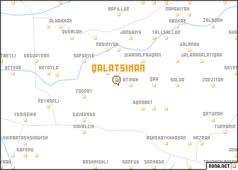
Qal‘at Sim‘ān (Syria)Qal‘at Sim‘ān is a town in Syria. An overview map of the region around Qal‘at Sim‘ān is displayed below.
regional and 3d topo map of Qal‘at Sim‘ān, Syria ::
Qal‘at Sim‘ān airports ::
The nearest airport is ALP - Aleppo Intl, located 51.8 km east of Qal‘at Sim‘ān.
Other airports nearby include GZT - Gaziantep Oguzeli (102.1 km north east), LTK - Latakia Bassel Al Assad Intl (119.0 km south west), ADA - Adana Incirlik Ab (135.6 km north west), ADA - Adana (145.3 km north west), Nearby towns ::
Āţimah (1.5km east) //
Bükülmez (2.4km north west) //
‘Aqrabāt (4.8km south east) //
Dīwān al Fawqānī (4.8km north east) //
Qâh (4.5km east) //
Dayr Ballūţ (5.6km north) //
Oğulpınar (4.8km west) //
Toğray (4.8km west) //
Nāşirīyah (5.8km north) //
Kafaldīn (5.8km south east) //
Safarîye (5.8km north west) //
Jandarīs (7.6km north) //
Güverada (7.1km south west) //
Mashhad Rūḩīn (7.0km south east) //
Ḩājjī Iskandar (8.0km north) //
Kavalcık (8.7km south west) //
Dīwān at Taḩtānī (8.7km north east) //
Tall Sallūr (9.5km north east) //
Qushlah (9.5km north west) //
[all distances 'as the bird flies' and approximate] 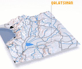 Places with similar names to Qal‘at Sim‘ān, Syria :: Disclaimer :: Information on this page comes without warranty of any kind |
||
|
Where is Qal‘at Sim‘ān? Elevation and coordinates ::
Latitude (lat): 36°18'0"N Longitude (lon): 36°40'0"E
Elevation (approx.): 201m (map arrows pan, magnifying glasses zoom) |
||
|
Visiting Qal‘at Sim‘ān? Hotel/Accommodation ::
Book a hotel in Qal‘at Sim‘ān Travel Guide ::
Buy a travel guide for Syria rental cars ::
car rental offers GPS waypoint ::
download a GPX waypoint (PoI) of Qal‘at Sim‘ān for your GPS receiver
|
||