|
search place name
|
||
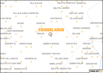
Raiaa al Hawāʼ (Idlib, Syria)Raiaa al Hawāʼ is a town in the Idlib region of Syria. An overview map of the region around Raiaa al Hawāʼ is displayed below.
regional and 3d topo map of Raiaa al Hawāʼ, Syria ::
Raiaa al Hawāʼ airports ::
The nearest airport is ALP - Aleppo Intl, located 70.9 km north of Raiaa al Hawāʼ.
Other airports nearby include LTK - Latakia Bassel Al Assad Intl (105.8 km west), PMS - Palmyra (156.4 km south east), GZT - Gaziantep Oguzeli (158.7 km north), ADA - Adana Incirlik Ab (220.4 km north west), Nearby towns ::
Duwādīyah (2.4km north east) //
Jubb al Rhasseb (3.7km south) //
Ramlah (3.0km west) //
Suray‘ah (4.8km north west) //
Ghuzaylah (4.5km east) //
Jahmān (5.6km north) //
Umm Ţamākh (5.8km north) //
Srâa (4.9km west) //
Maksar at Taḩtānī (7.4km south) //
Khayrīyah (7.1km south east) //
Ḩawā (7.1km south west) //
Khayrīyah aş Şaghīrah (8.2km south east) //
Rasm al Kibār (8.7km north east) //
Burtuqānah (8.7km north west) //
[all distances 'as the bird flies' and approximate]  Places with similar names to Raiaa al Hawāʼ, Syria :: Disclaimer :: Information on this page comes without warranty of any kind |
||
|
Where is Raiaa al Hawāʼ? Elevation and coordinates ::
Latitude (lat): 35°33'0"N Longitude (lon): 37°6'0"E
Elevation (approx.): 335m (map arrows pan, magnifying glasses zoom) |
||
|
Visiting Raiaa al Hawāʼ? Hotel/Accommodation ::
Book a hotel in Raiaa al Hawāʼ Travel Guide ::
Buy a travel guide for Syria rental cars ::
car rental offers GPS waypoint ::
download a GPX waypoint (PoI) of Raiaa al Hawāʼ for your GPS receiver
|
||