|
search place name
|
||
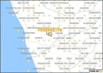
Raʼs ad Dayr (Ḩimş, Syria)Raʼs ad Dayr is a town in the Ḩimş region of Syria. An overview map of the region around Raʼs ad Dayr is displayed below.
regional and 3d topo map of Raʼs ad Dayr, Syria ::
Raʼs ad Dayr airports ::
The nearest airport is LTK - Latakia Bassel Al Assad Intl, located 71.0 km north of Raʼs ad Dayr.
Other airports nearby include BEY - Beirut Rafic Hariri Intl (115.7 km south west), DAM - Damascus Intl (156.8 km south), ALP - Aleppo Intl (191.2 km north east), RPN - Rosh Pina Mahanaim I Ben Yaakov (202.1 km south), Nearby towns ::
Raʼs ad Dayr (0.8km west) //
Ar Ruʼays (1.7km south west) //
Turkab (2.3km east) //
Al ‘Uraymah (2.8km south east) //
Bḩūzī (2.8km south west) //
Sā‘īn al Gharbīyah (3.1km north west) //
Samakah (3.1km north west) //
Ḑahr ad Duwayr (3.5km south) //
Kashfah (4.1km north) //
Kanāʼis (4.1km north) //
Matn aş Şafşāfah (4.1km south east) //
Aş Şafşāfah (4.1km south east) //
Muwaysinah (3.8km east) //
Ḩikr Bayt Shūfān al Fawqānī (4.6km north east) //
Khirbat al Ma‘zah (4.6km north west) //
Mī‘ār al Mchadd (4.6km north west) //
‘Abbūlī ‘Arīḑ (4.1km east) //
Quşayr (4.1km west) //
Waqf ash Shaykh ‘Ayyāsh (4.4km north west) //
Ar Rayḩānīyah (5.3km south) //
‘Ayn az Zubdah (5.1km south east) //
Wādī al Mīs (5.1km south east) //
Qal‘at Yuḩmur (5.7km south west) //
Huwaysīyah (5.7km south west) //
Ḑahr al Ḩajar (5.7km south west) //
At Tawānīn (5.3km east) //
Bshabţah (6.3km north) //
‘Abbūlī (5.5km east) //
Ḑahr Bashīr (5.5km east) //
[all distances 'as the bird flies' and approximate] 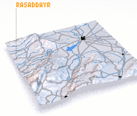 Places with similar names to Raʼs ad Dayr, Syria ::
Disclaimer :: Information on this page comes without warranty of any kind |
||
|
Where is Raʼs ad Dayr? Elevation and coordinates ::
Latitude (lat): 34°45'50"N Longitude (lon): 36°1'30"E
Elevation (approx.): 90m (map arrows pan, magnifying glasses zoom) |
||
|
Visiting Raʼs ad Dayr? Hotel/Accommodation ::
Book a hotel in Raʼs ad Dayr Travel Guide ::
Buy a travel guide for Syria rental cars ::
car rental offers GPS waypoint ::
download a GPX waypoint (PoI) of Raʼs ad Dayr for your GPS receiver
|
||