|
search place name
|
||
Şaffāt az Zirr (Ar Raqqah, Syria)Şaffāt az Zirr is a town in the Ar Raqqah region of Syria. An overview map of the region around Şaffāt az Zirr is displayed below.
regional and 3d topo map of Şaffāt az Zirr, Syria ::

Şaffāt az Zirr airports ::
The nearest airport is DEZ - Deire Zor Deir Zzor, located 70.0 km west of Şaffāt az Zirr.
Nearby towns ::
[all distances 'as the bird flies' and approximate] 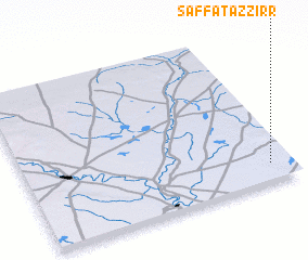
Disclaimer :: Information on this page comes without warranty of any kind |
||
|
Where is Şaffāt az Zirr? Elevation and coordinates ::
Latitude (lat): 35°7'0"N Longitude (lon): 40°55'0"E
Elevation (approx.): 192m (map arrows pan, magnifying glasses zoom) |
||
|
Visiting Şaffāt az Zirr? Hotel/Accommodation ::
Book a hotel in Şaffāt az Zirr Travel Guide ::
Buy a travel guide for Syria rental cars ::
car rental offers GPS waypoint ::
download a GPX waypoint (PoI) of Şaffāt az Zirr for your GPS receiver
|
||